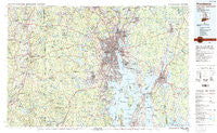
~ Providence RI topo map, 1:100000 scale, 30 X 60 Minute, Historical, 1984, updated 1985
Providence, Rhode Island, USGS topographic map dated 1984.
Includes geographic coordinates (latitude and longitude). This topographic map is suitable for hiking, camping, and exploring, or framing it as a wall map.
Printed on-demand using high resolution imagery, on heavy weight and acid free paper, or alternatively on a variety of synthetic materials.
Topos available on paper, Waterproof, Poly, or Tyvek. Usually shipping rolled, unless combined with other folded maps in one order.
- Product Number: USGS-5604640
- Free digital map download (high-resolution, GeoPDF): Providence, Rhode Island (file size: 33 MB)
- Map Size: please refer to the dimensions of the GeoPDF map above
- Weight (paper map): ca. 55 grams
- Map Type: POD USGS Topographic Map
- Map Series: HTMC
- Map Verison: Historical
- Cell ID: 68198
- Scan ID: 353384
- Imprint Year: 1985
- Woodland Tint: Yes
- Aerial Photo Year: 1977
- Edit Year: 1984
- Datum: NAD27
- Map Projection: Universal Transverse Mercator
- Map published by United States Geological Survey
- Map Language: English
- Scanner Resolution: 600 dpi
- Map Cell Name: Providence
- Grid size: 30 X 60 Minute
- Date on map: 1984
- Map Scale: 1:100000
- Geographical region: Rhode Island, United States
Neighboring Maps:
All neighboring USGS topo maps are available for sale online at a variety of scales.
Spatial coverage:
Topo map Providence, Rhode Island, covers the geographical area associated the following places:
- Horn Heap - Whitehall - Stillwater - Edgewood - Lockwood Corner - Ponaganset (historical) - Almyville - Norton - Miles Bridge - Kent (historical) - Liberty - Wightmans Corner - North Swansea - Attleboro Falls - Saylesville - Shippee Corner - Woods Corner - North Foster - North Grosvenor Dale - Brayton Point - Cranston - Potowomut - Gortons Corner - Comstock Gardens - Bliss Corners - Hope - Bowenville - South Seekonk - Luthers Corners - Oneco - Kirby Corner - Annawomscutt - Greystone - East Killingly - Manton - East Junction - Taunton - Geneva - Norton Grove - Cranstons Corner (historical) - Graniteville - Gidleys Corner - Slocums Corner - Warwick - Gazzaville - Frenchtown - Allenton - Barneyville - Wyoming - Jewett City - Hughesdale - Silver Hook - Olneyville - Thatch Cove (historical) - Hillcrest - Nayatt - Bristol Township - Central Village - North Dighton - Wayland (historical) - Old Warwick - Plum Beach - Handy Four Corners - Oaklawn - Foster - Oak Grove Village - Canterbury - Garden City - Preston City - South Swansea - Berkeley - North Scituate - Fort Hill (historical) - West Glocester - Valley Falls - Tripps Corner - Seekonk - Cocumscussoc (historical) - Quidnessett - Rice City - Williams Mill - Vue de l'eau - Mapleville - Plum Point - Fairlawn - Lippitt - Oakland - Acquidaneck (historical) - Buttonwoods - Copper Works - Lakeside - Lakewood - Escoheag - Harrisville - Tiverton Four Corners - Plainfield - Rockville - Old Buttonwoods - Steep Brook - Glasgo
- Map Area ID: AREA4241.5-72-71
- Northwest corner Lat/Long code: USGSNW42-72
- Northeast corner Lat/Long code: USGSNE42-71
- Southwest corner Lat/Long code: USGSSW41.5-72
- Southeast corner Lat/Long code: USGSSE41.5-71
- Northern map edge Latitude: 42
- Southern map edge Latitude: 41.5
- Western map edge Longitude: -72
- Eastern map edge Longitude: -71