
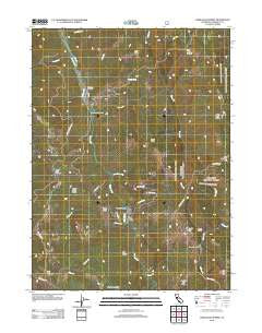
~ Lord Ellis Summit CA topo map, 1:24000 scale, 7.5 X 7.5 Minute, Historical, 2012
Lord Ellis Summit, California, USGS topographic map dated 2012.
Includes geographic coordinates (latitude and longitude). This topographic map is suitable for hiking, camping, and exploring, or framing it as a wall map.
Printed on-demand using high resolution imagery, on heavy weight and acid free paper, or alternatively on a variety of synthetic materials.
Topos available on paper, Waterproof, Poly, or Tyvek. Usually shipping rolled, unless combined with other folded maps in one order.
- Product Number: USGS-5603094
- Free digital map download (high-resolution, GeoPDF): Lord Ellis Summit, California (file size: 25 MB)
- Map Size: please refer to the dimensions of the GeoPDF map above
- Weight (paper map): ca. 55 grams
- Map Type: POD USGS Topographic Map
- Map Series: US Topo
- Map Verison: Historical
- Cell ID: 26593
- Datum: North American Datum of 1983
- Map Projection: Transverse Mercator
- Map Cell Name: Lord-Ellis Summit
- Grid size: 7.5 X 7.5 Minute
- Date on map: 2012
- Map Scale: 1:24000
- Geographical region: California, United States
Neighboring Maps:
All neighboring USGS topo maps are available for sale online at a variety of scales.
Spatial coverage:
Topo map Lord Ellis Summit, California, covers the geographical area associated the following places:
- Moon Creek - Redwood Creek Ranch - Pickle Spring - Toss-up Creek - Windy Creek - Princess Rock - Mason Gulch - Lord-Ellis Summit - Pine Ridge Summit - Indian Field Ridge - Fern Prairie - Bald Mountain - Berry Summit - Squirrel Tail Ridge - Low Gap Creek - Redwood School - Negro Joe Ridge - Green Point Ridge - Molasses Creek - Nixon Ridge - Lupton Creek - Camp Anderson - Green Point School (historical) - Green Point - Dunn Ridge - Captains Creek - Minor Creek - Larson Ranch (historical) - Sweathouse Creek - Circle Point
- Map Area ID: AREA4140.875-123.875-123.75
- Northwest corner Lat/Long code: USGSNW41-123.875
- Northeast corner Lat/Long code: USGSNE41-123.75
- Southwest corner Lat/Long code: USGSSW40.875-123.875
- Southeast corner Lat/Long code: USGSSE40.875-123.75
- Northern map edge Latitude: 41
- Southern map edge Latitude: 40.875
- Western map edge Longitude: -123.875
- Eastern map edge Longitude: -123.75


