
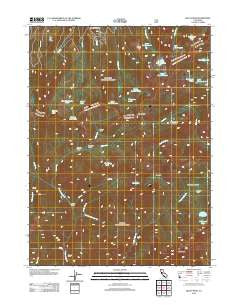
~ Billys Peak CA topo map, 1:24000 scale, 7.5 X 7.5 Minute, Historical, 2012
Billys Peak, California, USGS topographic map dated 2012.
Includes geographic coordinates (latitude and longitude). This topographic map is suitable for hiking, camping, and exploring, or framing it as a wall map.
Printed on-demand using high resolution imagery, on heavy weight and acid free paper, or alternatively on a variety of synthetic materials.
Topos available on paper, Waterproof, Poly, or Tyvek. Usually shipping rolled, unless combined with other folded maps in one order.
- Product Number: USGS-5602770
- Free digital map download (high-resolution, GeoPDF): Billys Peak, California (file size: 24 MB)
- Map Size: please refer to the dimensions of the GeoPDF map above
- Weight (paper map): ca. 55 grams
- Map Type: POD USGS Topographic Map
- Map Series: US Topo
- Map Verison: Historical
- Cell ID: 3940
- Datum: North American Datum of 1983
- Map Projection: Transverse Mercator
- Map Cell Name: Billys Peak
- Grid size: 7.5 X 7.5 Minute
- Date on map: 2012
- Map Scale: 1:24000
- Geographical region: California, United States
Neighboring Maps:
All neighboring USGS topo maps are available for sale online at a variety of scales.
Spatial coverage:
Topo map Billys Peak, California, covers the geographical area associated the following places:
- Stoddard Meadow - Billys Peak - Hodges Cabin - Section Line Lake - Francis Cabin - Milk Ranch Creek - Fox Creek Ridge - Mary Queen Mine - McDonald Lake - Bloody Run Creek - Doe Flat - Lick Creek - Wolford Cabin - Holland Mine - Wolford Gulch - Cement Banks - East Boulder Lake - Big Marshy Lake - Schuler Gulch - Upper Boulder Lake - West Boulder Lake - South Fork Little Lick Creek - Wolford Creek - Mill Creek Lake - Cement Creek - Granite Creek - Washbasin Lake - Klatt Mine - Eagle Creek Benches - Mosquito Lake - Stoddard Cabin - Stoddard Lake - Telephone Lake - Virginia Lake - Saloon Creek - Engle Mine - Lower Boulder Lake - Mavis Lake - Loftus Mine - Middle Boulder Lake - Little Lick Creek - Eagle Peak - Granite Lake - Doe Lake - Gypsy Queen Mine - Fox Creek Lake - Blue Jay Ridge - Little Marshy Lake
- Map Area ID: AREA41.2541.125-122.875-122.75
- Northwest corner Lat/Long code: USGSNW41.25-122.875
- Northeast corner Lat/Long code: USGSNE41.25-122.75
- Southwest corner Lat/Long code: USGSSW41.125-122.875
- Southeast corner Lat/Long code: USGSSE41.125-122.75
- Northern map edge Latitude: 41.25
- Southern map edge Latitude: 41.125
- Western map edge Longitude: -122.875
- Eastern map edge Longitude: -122.75


