
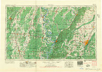
~ Jackson MS topo map, 1:250000 scale, 1 X 2 Degree, Historical, 1955, updated 1955
Jackson, Mississippi, USGS topographic map dated 1955.
Includes geographic coordinates (latitude and longitude). This topographic map is suitable for hiking, camping, and exploring, or framing it as a wall map.
Printed on-demand using high resolution imagery, on heavy weight and acid free paper, or alternatively on a variety of synthetic materials.
Topos available on paper, Waterproof, Poly, or Tyvek. Usually shipping rolled, unless combined with other folded maps in one order.
- Product Number: USGS-5599078
- Free digital map download (high-resolution, GeoPDF): Jackson, Mississippi (file size: 27 MB)
- Map Size: please refer to the dimensions of the GeoPDF map above
- Weight (paper map): ca. 55 grams
- Map Type: POD USGS Topographic Map
- Map Series: HTMC
- Map Verison: Historical
- Cell ID: 68839
- Scan ID: 337263
- Imprint Year: 1955
- Woodland Tint: Yes
- Field Check Year: 1955
- Datum: Unstated
- Map Projection: Transverse Mercator
- Map published by United States Army Corps of Engineers
- Map published by United States Army
- Map Language: English
- Scanner Resolution: 600 dpi
- Map Cell Name: Jackson
- Grid size: 1 X 2 Degree
- Date on map: 1955
- Map Scale: 1:250000
- Geographical region: Mississippi, United States
Neighboring Maps:
All neighboring USGS topo maps are available for sale online at a variety of scales.
Spatial coverage:
Topo map Jackson, Mississippi, covers the geographical area associated the following places:
- Duke - Signal - East Manor Estates - Shelburn - Lakeland - Delhi - Dixie Landing - Gilbert - Colby - Eden - Mountain Creek (historical) - Lake City - Oak Grove - Summertree - Villanova - Norwood - Arcadia (historical) - Davis - Woodmoor - Goodwill - Lakewood - Claibornesville (historical) - Cherry Park - Bordenax - Craig - Queens Hill - Phoenix - Dogwood Landing - Traceland North - Afton - Baskinton - Egremont - Millrun - Warsaw Ferry - Bellevule - Star - Stevenson - Audubon Park - Cayuga - Lake Providence - Gilleyville - Pilcher Point - Bear Creek - Gateway North - Speedway Mobile Home Park - Scotland - Brookwood Pines - Smiths - Atherton - Palestine - Fitler - Sheltons - Warren Place - Upland - Winnsboro - Fordyke - Barnes Prairie - Tensas - Robertdale (historical) - Western Hills - Dabney Crossroads - Big Creek - Dry Grove - Buckner - Warden - Moncure - Bastrop - Jackson Landing - Ratliff Landing - Tendal - Adams - Bellegrove - Bomer - Ashville (historical) - Englewood - Chethams (historical) - Lake Park - Woodville Heights - Southhaven - Ballground - Reganton - Sandalwood - Redbone - Hollands (historical) - Marcarco - Oakley - Woodhaven - Dogwood Place - Grand Gulf - Jackson - Melvin Heights - Swartz - Whitfield - Timberlane - Vernon - Chapel Landing - Lake Ridgelea Subdivision - North Town Plaza - Southall - Redwood
- Map Area ID: AREA3332-92-90
- Northwest corner Lat/Long code: USGSNW33-92
- Northeast corner Lat/Long code: USGSNE33-90
- Southwest corner Lat/Long code: USGSSW32-92
- Southeast corner Lat/Long code: USGSSE32-90
- Northern map edge Latitude: 33
- Southern map edge Latitude: 32
- Western map edge Longitude: -92
- Eastern map edge Longitude: -90


