
~ Hattiesburg MS topo map, 1:250000 scale, 1 X 2 Degree, Historical, 1984, updated 1984
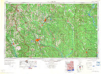
Hattiesburg, Mississippi, USGS topographic map dated 1984.
Includes geographic coordinates (latitude and longitude). This topographic map is suitable for hiking, camping, and exploring, or framing it as a wall map.
Printed on-demand using high resolution imagery, on heavy weight and acid free paper, or alternatively on a variety of synthetic materials.
Topos available on paper, Waterproof, Poly, or Tyvek. Usually shipping rolled, unless combined with other folded maps in one order.
- Product Number: USGS-5599076
- Free digital map download (high-resolution, GeoPDF): Hattiesburg, Mississippi (file size: 21 MB)
- Map Size: please refer to the dimensions of the GeoPDF map above
- Weight (paper map): ca. 55 grams
- Map Type: POD USGS Topographic Map
- Map Series: HTMC
- Map Verison: Historical
- Cell ID: 68818
- Scan ID: 707393
- Imprint Year: 1984
- Woodland Tint: Yes
- Visual Version Number: 2
- Aerial Photo Year: 1952
- Edit Year: 1970
- Field Check Year: 1953
- Datum: Unstated
- Map Projection: Transverse Mercator
- Map published by United States Army Corps of Engineers
- Map Language: English
- Scanner Resolution: 508 dpi
- Map Cell Name: Hattiesburg
- Grid size: 1 X 2 Degree
- Date on map: 1984
- Map Scale: 1:250000
- Geographical region: Mississippi, United States
Neighboring Maps:
All neighboring USGS topo maps are available for sale online at a variety of scales.
Spatial coverage:
Topo map Hattiesburg, Mississippi, covers the geographical area associated the following places:
- Westgate - Cold Springs - Vernal - Moselle - Whitfield - Pecan Grove - Rutan - Eastside - Good Hope - Jonathan - Coats - Stage Coach Woods - Talowah - Barlow - Sumrall - Wagarville - Columbia Springs (historical) - Pinola - Baxterville - Bassfield - Glendale - Innswood South - Barrontown - Pecan Grove Mobile Home Park - Keno (historical) - Byrd - Forrest Hills - Batson - Bay Springs - Bolinger - Union - Eminence - New Wakefield - Oak Bowery (historical) - Maddox - Arnold Line - Shelton - Shady Grove - Loper - Healing Springs - Hawthorn - Mendenhall - Lucas - Pleasant Hill - Cullomburg - Sandersville - Tallahomo - Carmich - De Soto - Chapel Hill - Union - Rainey - Tokio - Magee - Brewer - Oak Forrest - Mildred - Robinsons Junction - Dixie - Sims Chapel - Henderson - Petal Mobile Home Park - Pine Grove - Old Samuel - Mineral Springs - Summerland - Macedonia - Goss - Mohoba (historical) - Carson - Tallahala - Bowie - Creek (historical) - Barrytown - Wingate - Oak Bowery - Chicora - Richburg Heights - McNair - Mount Carmel - Saint Paul - Weems (historical) - Leaf - Lovelace - Kelona - Harvey - Bothwell - Edna - Sandy Hook - Hobson - New Haven - Four Points - Bellecrest Mobile Home Village - Liberty - Pine Ridge - Westville - Speedtown - Shady Grove - Rock Hill - Cohay
- Map Area ID: AREA3231-90-88
- Northwest corner Lat/Long code: USGSNW32-90
- Northeast corner Lat/Long code: USGSNE32-88
- Southwest corner Lat/Long code: USGSSW31-90
- Southeast corner Lat/Long code: USGSSE31-88
- Northern map edge Latitude: 32
- Southern map edge Latitude: 31
- Western map edge Longitude: -90
- Eastern map edge Longitude: -88


