
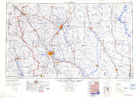
~ Hattiesburg MS topo map, 1:250000 scale, 1 X 2 Degree, Historical, 1984, updated 1984
Hattiesburg, Mississippi, USGS topographic map dated 1984.
Includes geographic coordinates (latitude and longitude). This topographic map is suitable for hiking, camping, and exploring, or framing it as a wall map.
Printed on-demand using high resolution imagery, on heavy weight and acid free paper, or alternatively on a variety of synthetic materials.
Topos available on paper, Waterproof, Poly, or Tyvek. Usually shipping rolled, unless combined with other folded maps in one order.
- Product Number: USGS-5599074
- Free digital map download (high-resolution, GeoPDF): Hattiesburg, Mississippi (file size: 12 MB)
- Map Size: please refer to the dimensions of the GeoPDF map above
- Weight (paper map): ca. 55 grams
- Map Type: POD USGS Topographic Map
- Map Series: HTMC
- Map Verison: Historical
- Cell ID: 68818
- Scan ID: 707392
- Imprint Year: 1984
- Visual Version Number: 1
- Aerial Photo Year: 1952
- Edit Year: 1970
- Field Check Year: 1953
- Datum: Unstated
- Map Projection: Transverse Mercator
- Map published by United States Army Corps of Engineers
- Map Language: English
- Scanner Resolution: 508 dpi
- Map Cell Name: Hattiesburg
- Grid size: 1 X 2 Degree
- Date on map: 1984
- Map Scale: 1:250000
- Geographical region: Mississippi, United States
Neighboring Maps:
All neighboring USGS topo maps are available for sale online at a variety of scales.
Spatial coverage:
Topo map Hattiesburg, Mississippi, covers the geographical area associated the following places:
- Woods Bluff - Martinville - Copeland - Tallahomo - Benmore - Heidelberg - Summerland - Tall Pines - Mount Zion - Zion Hill - Wallis - Bethel - Lamar Park - Bedford Woods - Carson City - Berkshire Hills - Woodhaven - Battles - Slater - Rock Hill - Saint Paul - Okahola - Movico - Oak Grove - D'Lo - Sandersville - Glaston - Hamage - Hoy - Westgate - Bothwell - Lone Star - Wardwell - Bucks - Ridgecrest Mobile Home Park - Good Hope - Woodlawn Court - Aquilla - Moss - Millry - Mount Olive - Jonathan - Bowie - Expose - Four Point - Lanham - Chappell Hill - Story (historical) - Hiwannee - Salitpa - Runnelstown - Amy - Bezer - Hawkes - Merry Hell - Loper - Friendship - Monarch - Richburg - Benjoe - Deer Park - Ellisville - McNeiders (historical) - Langsdale - Gandsi - Currie - Mineral Springs - Bassetts Creek - Reid Settlement - Blue Ridge - Talowah - Pot Likker Mobile Home Park - Fordsville (historical) - Johnson - Speedtown - Brewer - New Wakefield - Koenton - Burbank - Moselle - Sanford - Barrytown - Lovelace - McLain - Janice - New Hebron - Providence - Fayettehill - Clara - Epps - West Bend - Hebron - Baxterville - Flatwood - Melba - Sidney - Toxey - Wingate - Simpson - Crotts
- Map Area ID: AREA3231-90-88
- Northwest corner Lat/Long code: USGSNW32-90
- Northeast corner Lat/Long code: USGSNE32-88
- Southwest corner Lat/Long code: USGSSW31-90
- Southeast corner Lat/Long code: USGSSE31-88
- Northern map edge Latitude: 32
- Southern map edge Latitude: 31
- Western map edge Longitude: -90
- Eastern map edge Longitude: -88


