
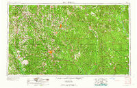
~ Hattiesburg MS topo map, 1:250000 scale, 1 X 2 Degree, Historical, 1958, updated 1958
Hattiesburg, Mississippi, USGS topographic map dated 1958.
Includes geographic coordinates (latitude and longitude). This topographic map is suitable for hiking, camping, and exploring, or framing it as a wall map.
Printed on-demand using high resolution imagery, on heavy weight and acid free paper, or alternatively on a variety of synthetic materials.
Topos available on paper, Waterproof, Poly, or Tyvek. Usually shipping rolled, unless combined with other folded maps in one order.
- Product Number: USGS-5599062
- Free digital map download (high-resolution, GeoPDF): Hattiesburg, Mississippi (file size: 23 MB)
- Map Size: please refer to the dimensions of the GeoPDF map above
- Weight (paper map): ca. 55 grams
- Map Type: POD USGS Topographic Map
- Map Series: HTMC
- Map Verison: Historical
- Cell ID: 68818
- Scan ID: 337257
- Imprint Year: 1958
- Woodland Tint: Yes
- Aerial Photo Year: 1952
- Field Check Year: 1953
- Datum: Unstated
- Map Projection: Transverse Mercator
- Map published by United States Army Corps of Engineers
- Map published by United States Army
- Map Language: English
- Scanner Resolution: 600 dpi
- Map Cell Name: Hattiesburg
- Grid size: 1 X 2 Degree
- Date on map: 1958
- Map Scale: 1:250000
- Geographical region: Mississippi, United States
Neighboring Maps:
All neighboring USGS topo maps are available for sale online at a variety of scales.
Spatial coverage:
Topo map Hattiesburg, Mississippi, covers the geographical area associated the following places:
- Haney - Ora - Woods Bluff - Robinsons Junction - Berkshire Hills - Brewer - Battles - Whitfield - Lux - Pistol Ridge - Benmore - Sumrall - Sauer - Rhodes - Pecan Grove - Dwight - Arnold Line - Barlow - Laton Hill - Fairford - Nancy - Jackson Spur - Seaboard - Clara - Hathorn - Hurricane Creek - Heatherwood Estates - Mendenhall - Rainey - Purvis - Wimbly - Pinebur - Mildred - Mish - Deer Park - Knobtown - Lambert Grove - Hanford - Oloh - Hercules Station - Corinth - Saint Stephens - Frankville - Richburg - State Line - Wells Town - Pineola - Mount Vernon - Buckatunna - Pot Likker Mobile Home Park - Carson - Water Valley - Mars Hill - Carmichael - Dexter - Mineral Springs - Cortelyou - Millry - Cyclone - Lou - Paragon - Errata - Improve - Rock Springs - Seneca - Yarbo - Leakesville - Saxon - Westville - Runnelstown - Dixie Pine - Bunker Hill - Salitpa - Sunrise - Acme - Walley - White Bluff - Vernal - Laurel - Mannassa - Ralston - Vinegar Bend - Lamar Pines Mobile Home Community - Foxworth - Cooley Springs - Carterville - Lucas - Rounsaville - Gwinville - Mount Horeb - Ellisville - Emmanuel - McLain - Bladon Springs - Melvin - Rawls Springs - Chastang - Collins - Stringer - Turner
- Map Area ID: AREA3231-90-88
- Northwest corner Lat/Long code: USGSNW32-90
- Northeast corner Lat/Long code: USGSNE32-88
- Southwest corner Lat/Long code: USGSSW31-90
- Southeast corner Lat/Long code: USGSSE31-88
- Northern map edge Latitude: 32
- Southern map edge Latitude: 31
- Western map edge Longitude: -90
- Eastern map edge Longitude: -88


