
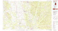
~ West Point MS topo map, 1:100000 scale, 30 X 60 Minute, Historical, 1982, updated 1983
West Point, Mississippi, USGS topographic map dated 1982.
Includes geographic coordinates (latitude and longitude). This topographic map is suitable for hiking, camping, and exploring, or framing it as a wall map.
Printed on-demand using high resolution imagery, on heavy weight and acid free paper, or alternatively on a variety of synthetic materials.
Topos available on paper, Waterproof, Poly, or Tyvek. Usually shipping rolled, unless combined with other folded maps in one order.
- Product Number: USGS-5599040
- Free digital map download (high-resolution, GeoPDF): West Point, Mississippi (file size: 22 MB)
- Map Size: please refer to the dimensions of the GeoPDF map above
- Weight (paper map): ca. 55 grams
- Map Type: POD USGS Topographic Map
- Map Series: HTMC
- Map Verison: Historical
- Cell ID: 68573
- Scan ID: 337245
- Imprint Year: 1983
- Woodland Tint: Yes
- Aerial Photo Year: 1980
- Edit Year: 1982
- Datum: NAD27
- Map Projection: Universal Transverse Mercator
- Map published by United States Geological Survey
- Map Language: English
- Scanner Resolution: 600 dpi
- Map Cell Name: West Point
- Grid size: 30 X 60 Minute
- Date on map: 1982
- Map Scale: 1:100000
- Geographical region: Mississippi, United States
Neighboring Maps:
All neighboring USGS topo maps are available for sale online at a variety of scales.
Spatial coverage:
Topo map West Point, Mississippi, covers the geographical area associated the following places:
- Vasser - Central Park - Gladneyville (historical) - Bedford - Woodland Heights - Fox Run - Waterfront Estates - Egypt - Palo Alto - Melborne - Ellis Subdivision - Enon - Bristo (historical) - Greenacres - Holly Hills - Acker (historical) - Mhoons Valley - Rocky Hill - Beeks (historical) - Hightogy - Griffith - Millport - Cauhorn (historical) - Walkers Gin - Easthaven - Hillcrest - Abbott - Crossville - Prairie - Point Harbor - Bent Tree Plantation - New Hamilton - Houston - Labelle Estates - Tucker Place - Border Springs (historical) - Kingville - Flint Hill - Molloy - Muldrow - Terrells (historical) - Greenbrier (historical) - Buena Vista - Buttahatchie (historical) - Parkersburg - Highland Park - Harmon Subdivision - New Wren - New York (historical) - Grubb Springs (historical) - Goose Pond (historical) - Oakridge Estates - Ashland (historical) - Bacon (historical) - Wise Gap - Sycamore (historical) - Sipsey Fork - Bolivar (historical) - Glenwood - Bluecutt Estates - Newport (historical) - Woodcrest - Rodgers (historical) - Jolly - Gattman - Stanford - Aberdeen - Sulligent - Sykes (historical) - Amory - Bells - Roanoke Estates - Pheba - Oakdale Park - Gardenspot Subdivision - Barrs Mill - Kolola Springs - Stephen - Jones Subdivision - Parkview - Lackey - Fox Run Colony - Green Acres - Carroll Subdivision - Vernon - Cotton Hill Gin Estates - Ridgeland - Pine Acres - Willcox (historical) - Splunge - Chins Springs (historical) - Prospect (historical) - Hopewell - Crews - Melco Subdivision - Pine Springs - Tibbee - Watkins Subdivision - Siloam - Macedonia
- Map Area ID: AREA3433.5-89-88
- Northwest corner Lat/Long code: USGSNW34-89
- Northeast corner Lat/Long code: USGSNE34-88
- Southwest corner Lat/Long code: USGSSW33.5-89
- Southeast corner Lat/Long code: USGSSE33.5-88
- Northern map edge Latitude: 34
- Southern map edge Latitude: 33.5
- Western map edge Longitude: -89
- Eastern map edge Longitude: -88


