
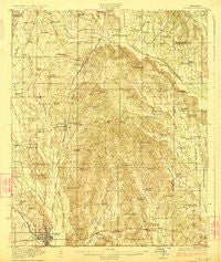
~ Tupelo MS topo map, 1:62500 scale, 15 X 15 Minute, Historical, 1923
Tupelo, Mississippi, USGS topographic map dated 1923.
Includes geographic coordinates (latitude and longitude). This topographic map is suitable for hiking, camping, and exploring, or framing it as a wall map.
Printed on-demand using high resolution imagery, on heavy weight and acid free paper, or alternatively on a variety of synthetic materials.
Topos available on paper, Waterproof, Poly, or Tyvek. Usually shipping rolled, unless combined with other folded maps in one order.
- Product Number: USGS-5598836
- Free digital map download (high-resolution, GeoPDF): Tupelo, Mississippi (file size: 8 MB)
- Map Size: please refer to the dimensions of the GeoPDF map above
- Weight (paper map): ca. 55 grams
- Map Type: POD USGS Topographic Map
- Map Series: HTMC
- Map Verison: Historical
- Cell ID: 63752
- Scan ID: 337125
- Woodland Tint: Yes
- Survey Year: 1921
- Datum: NAD
- Map Projection: Polyconic
- Map published by United States Geological Survey
- Map Language: English
- Scanner Resolution: 600 dpi
- Map Cell Name: Tupelo
- Grid size: 15 X 15 Minute
- Date on map: 1923
- Map Scale: 1:62500
- Geographical region: Mississippi, United States
Neighboring Maps:
All neighboring USGS topo maps are available for sale online at a variety of scales.
Spatial coverage:
Topo map Tupelo, Mississippi, covers the geographical area associated the following places:
- Dorsey - Livingston Subdivision - Lake Appaloosa Estates - Tupelo - Indian Hills - Lake Piomingo - Ackia Gardens - Saltillo - Savery Acres - Confederate Park - Parkway - Lakeview - Francis Subdivision - Madison Heights - Mooreville - Unity - Lee-Wamba Subdivision - Pine Hill - Ratliff - Terrace Park - Skyline - Centerville - Flowerdale - Auburn - Bristow Acres - Knights Acres - Oakridge - Chapelville - Briarwood - Northwood Drive - Post Estates - Lumpkin Subdivision - Shady Acres - Meadowview - Boggan Grove - Green Acres - Edgemont - Wilemon - Wright Subdivision - Shiloh - Pinecrest - Lar-Eli-Do - Linwood Subdivision - Eastwood Place - Campbellton (historical) - Brennan Subdivision - Belledeer Hills - Johnson Heights - Clark Place - Priceville - Rogers Acres - Chateau Le Blanc - Suburban Acres - Rebecca Heights - Blair - Foxmoor - North Park - Beech Springs - Pratts - Presley Circle - Pinehurst - Applewood - Allyson Hills - Park Monceau - Horton Subdivision - Harrisburg Heights - Northwood Estates - Forest Hills - Eggville - Highland Circle - Patterson Subdivision - Oakcliff Villas - Sharon Hills - Guntown
- Map Area ID: AREA34.534.25-88.75-88.5
- Northwest corner Lat/Long code: USGSNW34.5-88.75
- Northeast corner Lat/Long code: USGSNE34.5-88.5
- Southwest corner Lat/Long code: USGSSW34.25-88.75
- Southeast corner Lat/Long code: USGSSE34.25-88.5
- Northern map edge Latitude: 34.5
- Southern map edge Latitude: 34.25
- Western map edge Longitude: -88.75
- Eastern map edge Longitude: -88.5


