
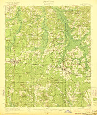
~ Forest MS topo map, 1:62500 scale, 15 X 15 Minute, Historical, 1922
Forest, Mississippi, USGS topographic map dated 1922.
Includes geographic coordinates (latitude and longitude). This topographic map is suitable for hiking, camping, and exploring, or framing it as a wall map.
Printed on-demand using high resolution imagery, on heavy weight and acid free paper, or alternatively on a variety of synthetic materials.
Topos available on paper, Waterproof, Poly, or Tyvek. Usually shipping rolled, unless combined with other folded maps in one order.
- Product Number: USGS-5598428
- Free digital map download (high-resolution, GeoPDF): Forest, Mississippi (file size: 8 MB)
- Map Size: please refer to the dimensions of the GeoPDF map above
- Weight (paper map): ca. 55 grams
- Map Type: POD USGS Topographic Map
- Map Series: HTMC
- Map Verison: Historical
- Cell ID: 54235
- Scan ID: 336906
- Woodland Tint: Yes
- Visual Version Number: 1
- Survey Year: 1920
- Datum: Unstated
- Map Projection: Polyconic
- Map published by United States Geological Survey
- Map Language: English
- Scanner Resolution: 600 dpi
- Map Cell Name: Forest
- Grid size: 15 X 15 Minute
- Date on map: 1922
- Map Scale: 1:62500
- Geographical region: Mississippi, United States
Neighboring Maps:
All neighboring USGS topo maps are available for sale online at a variety of scales.
Spatial coverage:
Topo map Forest, Mississippi, covers the geographical area associated the following places:
- Usrytown - Little Italy - Forest - Tanglewood - Muskegon - Singleton Settlement - Ball Hill - Conehatta - Steele - East Hillsboro - Donohoe - Lake - Buckleytown - Gum Spring - Piketown - Fikestown - Patrons Union (historical) - Bartlett - Harperville - Wolf - Norris - Dennis Settlement - Hazel
- Map Area ID: AREA32.532.25-89.5-89.25
- Northwest corner Lat/Long code: USGSNW32.5-89.5
- Northeast corner Lat/Long code: USGSNE32.5-89.25
- Southwest corner Lat/Long code: USGSSW32.25-89.5
- Southeast corner Lat/Long code: USGSSE32.25-89.25
- Northern map edge Latitude: 32.5
- Southern map edge Latitude: 32.25
- Western map edge Longitude: -89.5
- Eastern map edge Longitude: -89.25


