
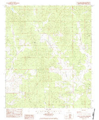
~ Little Sand Creek MS topo map, 1:24000 scale, 7.5 X 7.5 Minute, Historical, 1983, updated 1984
Little Sand Creek, Mississippi, USGS topographic map dated 1983.
Includes geographic coordinates (latitude and longitude). This topographic map is suitable for hiking, camping, and exploring, or framing it as a wall map.
Printed on-demand using high resolution imagery, on heavy weight and acid free paper, or alternatively on a variety of synthetic materials.
Topos available on paper, Waterproof, Poly, or Tyvek. Usually shipping rolled, unless combined with other folded maps in one order.
- Product Number: USGS-5596688
- Free digital map download (high-resolution, GeoPDF): Little Sand Creek, Mississippi (file size: 11 MB)
- Map Size: please refer to the dimensions of the GeoPDF map above
- Weight (paper map): ca. 55 grams
- Map Type: POD USGS Topographic Map
- Map Series: HTMC
- Map Verison: Historical
- Cell ID: 26039
- Scan ID: 335997
- Imprint Year: 1984
- Woodland Tint: Yes
- Aerial Photo Year: 1979
- Edit Year: 1983
- Field Check Year: 1980
- Datum: NAD27
- Map Projection: Transverse Mercator
- Provisional map: Yes
- Map published by United States Geological Survey
- Map Language: English
- Scanner Resolution: 600 dpi
- Map Cell Name: Little Sand Creek
- Grid size: 7.5 X 7.5 Minute
- Date on map: 1983
- Map Scale: 1:24000
- Geographical region: Mississippi, United States
Neighboring Maps:
All neighboring USGS topo maps are available for sale online at a variety of scales.
Spatial coverage:
Topo map Little Sand Creek, Mississippi, covers the geographical area associated the following places:
- Edgeworth Cemetery - Macedonia Church - Supervisor District 1 - Mount Vernon School - Greenboro Cemetery - Supervisor District 3 - Old Greenboro Cemetery - Bogue Watershed Y-30-53 Dam - Macedonia Cemetery - Pine Forest Church - Sand Creek - Edward Springs Church - Mount Vernon Cemetery - Little Sand Creek - Edward Springs Cemetery - Greensboro (historical) - Pine Forest Cemetery - Greenboro Church - Greensboro Methodist Church (historical) - Mount Vernon Church - Wood Chapel - Edgeworth Church - Hightower Cemetery
- Map Area ID: AREA33.62533.5-89.5-89.375
- Northwest corner Lat/Long code: USGSNW33.625-89.5
- Northeast corner Lat/Long code: USGSNE33.625-89.375
- Southwest corner Lat/Long code: USGSSW33.5-89.5
- Southeast corner Lat/Long code: USGSSE33.5-89.375
- Northern map edge Latitude: 33.625
- Southern map edge Latitude: 33.5
- Western map edge Longitude: -89.5
- Eastern map edge Longitude: -89.375


