
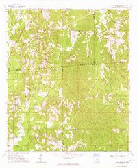
~ Heidelberg SW MS topo map, 1:24000 scale, 7.5 X 7.5 Minute, Historical, 1964, updated 1965
Heidelberg SW, Mississippi, USGS topographic map dated 1964.
Includes geographic coordinates (latitude and longitude). This topographic map is suitable for hiking, camping, and exploring, or framing it as a wall map.
Printed on-demand using high resolution imagery, on heavy weight and acid free paper, or alternatively on a variety of synthetic materials.
Topos available on paper, Waterproof, Poly, or Tyvek. Usually shipping rolled, unless combined with other folded maps in one order.
- Product Number: USGS-5596276
- Free digital map download (high-resolution, GeoPDF): Heidelberg SW, Mississippi (file size: 13 MB)
- Map Size: please refer to the dimensions of the GeoPDF map above
- Weight (paper map): ca. 55 grams
- Map Type: POD USGS Topographic Map
- Map Series: HTMC
- Map Verison: Historical
- Cell ID: 19999
- Scan ID: 335785
- Imprint Year: 1965
- Woodland Tint: Yes
- Aerial Photo Year: 1960
- Field Check Year: 1964
- Datum: NAD27
- Map Projection: Polyconic
- Map published by United States Geological Survey
- Map Language: English
- Scanner Resolution: 600 dpi
- Map Cell Name: Heidelberg SW
- Grid size: 7.5 X 7.5 Minute
- Date on map: 1964
- Map Scale: 1:24000
- Geographical region: Mississippi, United States
Neighboring Maps:
All neighboring USGS topo maps are available for sale online at a variety of scales.
Spatial coverage:
Topo map Heidelberg SW, Mississippi, covers the geographical area associated the following places:
- Pine Grove Church - West Eucutta Oil Field - New Bethlehem Church (historical) - Beaverdam Volunteer Fire Department - Blackledge Cemetery - McFarland Cemetery - Sky View Church - Bethel Church - Hubbard Creek - Beaverdam School (historical) - Bryant School (historical) - Bryan Oil Field - Barkley Store (historical) - Red Hill Church - Beaver Meadow Church - Bogue Homo School - Brownley Lake Dam - Bethel Cemetery - Zion Rest Cemetery - Oakland Grove Baptist Church - Oak Grove Cemetery - Choctaw Cemetery - Beaver Creek - Beaver Meadow Volunteer Fire Department - McGills Bridge (historical) - Choctaw Church - Florence Church - Oak Grove Church (historical) - McFarland Church - Piney Creek - Taylor Line School (historical) - Terrell Creek - Oak Grove School (historical) - Sallys Branch - Zions Rest Church - Florence Cemetery
- Map Area ID: AREA31.87531.75-89-88.875
- Northwest corner Lat/Long code: USGSNW31.875-89
- Northeast corner Lat/Long code: USGSNE31.875-88.875
- Southwest corner Lat/Long code: USGSSW31.75-89
- Southeast corner Lat/Long code: USGSSE31.75-88.875
- Northern map edge Latitude: 31.875
- Southern map edge Latitude: 31.75
- Western map edge Longitude: -89
- Eastern map edge Longitude: -88.875


