
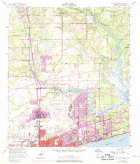
~ Gulfport North MS topo map, 1:24000 scale, 7.5 X 7.5 Minute, Historical, 1954, updated 1971
Gulfport North, Mississippi, USGS topographic map dated 1954.
Includes geographic coordinates (latitude and longitude). This topographic map is suitable for hiking, camping, and exploring, or framing it as a wall map.
Printed on-demand using high resolution imagery, on heavy weight and acid free paper, or alternatively on a variety of synthetic materials.
Topos available on paper, Waterproof, Poly, or Tyvek. Usually shipping rolled, unless combined with other folded maps in one order.
- Product Number: USGS-5596198
- Free digital map download (high-resolution, GeoPDF): Gulfport North, Mississippi (file size: 13 MB)
- Map Size: please refer to the dimensions of the GeoPDF map above
- Weight (paper map): ca. 55 grams
- Map Type: POD USGS Topographic Map
- Map Series: HTMC
- Map Verison: Historical
- Cell ID: 18729
- Scan ID: 335744
- Imprint Year: 1971
- Woodland Tint: Yes
- Photo Revision Year: 1970
- Field Check Year: 1954
- Survey Year: 1951
- Datum: NAD27
- Map Projection: Polyconic
- Map published by United States Geological Survey
- Map published by United States Department of Commerce
- Map Language: English
- Scanner Resolution: 600 dpi
- Map Cell Name: Gulfport North
- Grid size: 7.5 X 7.5 Minute
- Date on map: 1954
- Map Scale: 1:24000
- Geographical region: Mississippi, United States
Neighboring Maps:
All neighboring USGS topo maps are available for sale online at a variety of scales.
Spatial coverage:
Topo map Gulfport North, Mississippi, covers the geographical area associated the following places:
- Landon - Smallwood Mobile Home Park - Epico (historical) - Oaks Mobile Home Park - North Gulfport - Nugent - Arlington Heights Mobile Home Park - Shady Oak Mobile Park - Hidden Acres Mobile Home Park - Pettis Mobile Park - Orange Grove - Kathy Mobile Park - West Gulfport - Bulah - Woodcocks Mobile Home Park - Coalville - Cypress Bay Mobile Home Park - Poolside Mobile Home Village - Paradise Park Mobile Home Park - Grasslawn Mobile Home Park - Town Mobile Home Park - Loraine - Bayou Oaks Mobile Home Park - Couves Mobile Home Park - Mississippi City - Fernwood Trailer Court - Handsboro
- Map Area ID: AREA30.530.375-89.125-89
- Northwest corner Lat/Long code: USGSNW30.5-89.125
- Northeast corner Lat/Long code: USGSNE30.5-89
- Southwest corner Lat/Long code: USGSSW30.375-89.125
- Southeast corner Lat/Long code: USGSSE30.375-89
- Northern map edge Latitude: 30.5
- Southern map edge Latitude: 30.375
- Western map edge Longitude: -89.125
- Eastern map edge Longitude: -89


