
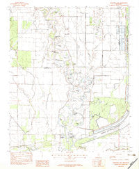
~ Fishhook Lake MS topo map, 1:24000 scale, 7.5 X 7.5 Minute, Historical, 1982, updated 1983
Fishhook Lake, Mississippi, USGS topographic map dated 1982.
Includes geographic coordinates (latitude and longitude). This topographic map is suitable for hiking, camping, and exploring, or framing it as a wall map.
Printed on-demand using high resolution imagery, on heavy weight and acid free paper, or alternatively on a variety of synthetic materials.
Topos available on paper, Waterproof, Poly, or Tyvek. Usually shipping rolled, unless combined with other folded maps in one order.
- Product Number: USGS-5596020
- Free digital map download (high-resolution, GeoPDF): Fishhook Lake, Mississippi (file size: 9 MB)
- Map Size: please refer to the dimensions of the GeoPDF map above
- Weight (paper map): ca. 55 grams
- Map Type: POD USGS Topographic Map
- Map Series: HTMC
- Map Verison: Historical
- Cell ID: 15369
- Scan ID: 335647
- Imprint Year: 1983
- Woodland Tint: Yes
- Aerial Photo Year: 1978
- Edit Year: 1982
- Field Check Year: 1982
- Datum: NAD27
- Map Projection: Transverse Mercator
- Provisional map: Yes
- Map published by United States Geological Survey
- Map Language: English
- Scanner Resolution: 600 dpi
- Map Cell Name: Fishhook Lake
- Grid size: 7.5 X 7.5 Minute
- Date on map: 1982
- Map Scale: 1:24000
- Geographical region: Mississippi, United States
Neighboring Maps:
All neighboring USGS topo maps are available for sale online at a variety of scales.
Spatial coverage:
Topo map Fishhook Lake, Mississippi, covers the geographical area associated the following places:
- Croudip Lake - Brushy Bayou - Burnt Brake - Oxbow Cut -Off - Oxbow Lake - Muddy Bayou - Duck Roost Lake - Puncheon Bayou - Boyce Lake - Black Lake - Yonkapin Lake - Twin Lake - Horseshoe Lake Cut -Off - Patterson Lakes - Brushy Bayou - Little Frazier Bayou - New Macedonia Cemetery - Houston School (historical) - Clear Creek Church - Twin Lakes Cut -Off - Supervisor District 2 - White Lake - Black Bayou - White Lake Cut -Off - Dry Bayou - Coldwater River National Wildlife Refuge - Stovall Bayou - Horseshoe Lake - New Macedonia Church - Oxbows Landing (historical) - Stringer Lake - Oakland Lake Cut -Off - Round Lake - Fishhook Lake - Dry Bayou Plantation - Hurricane Bayou - Thorn Lake - Horseshoe Lake - White Lake Church - Black Bayou - Tillatoba Creek - Oakland Lake
- Map Area ID: AREA34.12534-90.25-90.125
- Northwest corner Lat/Long code: USGSNW34.125-90.25
- Northeast corner Lat/Long code: USGSNE34.125-90.125
- Southwest corner Lat/Long code: USGSSW34-90.25
- Southeast corner Lat/Long code: USGSSE34-90.125
- Northern map edge Latitude: 34.125
- Southern map edge Latitude: 34
- Western map edge Longitude: -90.25
- Eastern map edge Longitude: -90.125


