
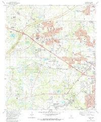
~ Clinton MS topo map, 1:24000 scale, 7.5 X 7.5 Minute, Historical, 1980, updated 1988
Clinton, Mississippi, USGS topographic map dated 1980.
Includes geographic coordinates (latitude and longitude). This topographic map is suitable for hiking, camping, and exploring, or framing it as a wall map.
Printed on-demand using high resolution imagery, on heavy weight and acid free paper, or alternatively on a variety of synthetic materials.
Topos available on paper, Waterproof, Poly, or Tyvek. Usually shipping rolled, unless combined with other folded maps in one order.
- Product Number: USGS-5595702
- Free digital map download (high-resolution, GeoPDF): Clinton, Mississippi (file size: 12 MB)
- Map Size: please refer to the dimensions of the GeoPDF map above
- Weight (paper map): ca. 55 grams
- Map Type: POD USGS Topographic Map
- Map Series: HTMC
- Map Verison: Historical
- Cell ID: 9205
- Scan ID: 335484
- Imprint Year: 1988
- Woodland Tint: Yes
- Aerial Photo Year: 1977
- Edit Year: 1980
- Field Check Year: 1979
- Datum: NAD27
- Map Projection: Transverse Mercator
- Map published by United States Geological Survey
- Map Language: English
- Scanner Resolution: 600 dpi
- Map Cell Name: Clinton
- Grid size: 7.5 X 7.5 Minute
- Date on map: 1980
- Map Scale: 1:24000
- Geographical region: Mississippi, United States
Neighboring Maps:
All neighboring USGS topo maps are available for sale online at a variety of scales.
Spatial coverage:
Topo map Clinton, Mississippi, covers the geographical area associated the following places:
- Clinton - Trailwood - Springridge Mobile Estates - Bradie - Willowood - Dixon - The Islands - Cherry Park - Speedway Mobile Home Park - Magnolia Terrace - Gaylyn Terrace - Thompson - Westchester Hills - Shadow Lake Estates - Lakeridge - Meadow Oaks - Van Winkle - Cedar Hills - Country Woods - Forest Green - Dixon Road Mobile Home Park - Huntcliff - The Briars - Queens Lane - Brookhollow Place - Pine Lea - Carriage Hills - Woodmoor - Lakeside - Dixon Acres - Forest Park Estates - McRaven - The Meadows of Trailwood - Breckenridge - Oak Creek - Shady Springs Mobile Home Community - Woodville Heights - Edgewood Acres - Presidential Hills - Byrd Heights - Green Acres - Easthaven - The Cascades - Western Hills - Forest Hill - Meadowhill - Bottom Acres - Kentwood
- Map Area ID: AREA32.37532.25-90.375-90.25
- Northwest corner Lat/Long code: USGSNW32.375-90.375
- Northeast corner Lat/Long code: USGSNE32.375-90.25
- Southwest corner Lat/Long code: USGSSW32.25-90.375
- Southeast corner Lat/Long code: USGSSE32.25-90.25
- Northern map edge Latitude: 32.375
- Southern map edge Latitude: 32.25
- Western map edge Longitude: -90.375
- Eastern map edge Longitude: -90.25


