
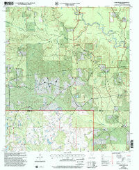
~ Bond Pond MS topo map, 1:24000 scale, 7.5 X 7.5 Minute, Historical, 2000, updated 2002
Bond Pond, Mississippi, USGS topographic map dated 2000.
Includes geographic coordinates (latitude and longitude). This topographic map is suitable for hiking, camping, and exploring, or framing it as a wall map.
Printed on-demand using high resolution imagery, on heavy weight and acid free paper, or alternatively on a variety of synthetic materials.
Topos available on paper, Waterproof, Poly, or Tyvek. Usually shipping rolled, unless combined with other folded maps in one order.
- Product Number: USGS-5595464
- Free digital map download (high-resolution, GeoPDF): Bond Pond, Mississippi (file size: 17 MB)
- Map Size: please refer to the dimensions of the GeoPDF map above
- Weight (paper map): ca. 55 grams
- Map Type: POD USGS Topographic Map
- Map Series: HTMC
- Map Verison: Historical
- Cell ID: 4773
- Scan ID: 335366
- Imprint Year: 2002
- Woodland Tint: Yes
- Aerial Photo Year: 1998
- Datum: NAD27
- Map Projection: Transverse Mercator
- Map published by United States Geological Survey
- Map published by United States Forest Service
- Map Language: English
- Scanner Resolution: 600 dpi
- Map Cell Name: Bond Pond
- Grid size: 7.5 X 7.5 Minute
- Date on map: 2000
- Map Scale: 1:24000
- Geographical region: Mississippi, United States
Neighboring Maps:
All neighboring USGS topo maps are available for sale online at a variety of scales.
Spatial coverage:
Topo map Bond Pond, Mississippi, covers the geographical area associated the following places:
- Cypress Creek Landing - Black Branch - Griffin Spring Branch - Jumping Creek - New Covenant Assembly of God Church - Bond Pond - New York Cemetery - Andrews Chapel - Taylor Cmetery - Sandy Run - Bluff Creek School (historical) - Black Creek Wilderness - Mossy Creek - Amanda Chapel Baptist Church - Pleasant Hill Church - Thomas Bay Branch - Sims Cemetery - Mill Creek - Stillhouse Branch - New York School (historical) - Prescott Lake Dam - Fairley Cemetery - Cypress Creek - Blue Goose Branch - Cypress Creek Landing Recreation Site - Janice Landing Recreation Site - Howard-Breland Cemetery - Ebenezer Church - Clear Creek - Haynes Lake Dam - Thomas Branch - Haynes Lake Dam - Beaverdam Creek - Taylor Cemetery
- Map Area ID: AREA3130.875-89.125-89
- Northwest corner Lat/Long code: USGSNW31-89.125
- Northeast corner Lat/Long code: USGSNE31-89
- Southwest corner Lat/Long code: USGSSW30.875-89.125
- Southeast corner Lat/Long code: USGSSE30.875-89
- Northern map edge Latitude: 31
- Southern map edge Latitude: 30.875
- Western map edge Longitude: -89.125
- Eastern map edge Longitude: -89


