
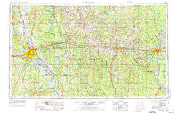
~ Shreveport LA topo map, 1:250000 scale, 1 X 2 Degree, Historical, 1955, updated 1975
Shreveport, Louisiana, USGS topographic map dated 1955.
Includes geographic coordinates (latitude and longitude). This topographic map is suitable for hiking, camping, and exploring, or framing it as a wall map.
Printed on-demand using high resolution imagery, on heavy weight and acid free paper, or alternatively on a variety of synthetic materials.
Topos available on paper, Waterproof, Poly, or Tyvek. Usually shipping rolled, unless combined with other folded maps in one order.
- Product Number: USGS-5595194
- Free digital map download (high-resolution, GeoPDF): Shreveport, Louisiana (file size: 21 MB)
- Map Size: please refer to the dimensions of the GeoPDF map above
- Weight (paper map): ca. 55 grams
- Map Type: POD USGS Topographic Map
- Map Series: HTMC
- Map Verison: Historical
- Cell ID: 69030
- Scan ID: 335228
- Imprint Year: 1975
- Woodland Tint: Yes
- Aerial Photo Year: 1972
- Edit Year: 1973
- Field Check Year: 1955
- Datum: Unstated
- Map Projection: Transverse Mercator
- Map published by United States Army
- Map Language: English
- Scanner Resolution: 600 dpi
- Map Cell Name: Shreveport
- Grid size: 1 X 2 Degree
- Date on map: 1955
- Map Scale: 1:250000
- Geographical region: Louisiana, United States
Neighboring Maps:
All neighboring USGS topo maps are available for sale online at a variety of scales.
Spatial coverage:
Topo map Shreveport, Louisiana, covers the geographical area associated the following places:
- Quigley - Clarks - Castor - Colquitt - Dogwood Estates - Martin - Oil City - Staples - Waterwood Estates - Dorian Terrace - Dixie Gardens - Elkins - Fowler - The Meadows - Lawhon - Lisbon - Downsville - Cox Crossing - Evergreen - Coushatta - Espanita Forest - Ferguson - Clayton (historical) - Bear Creek - Dodson - Shoreline - Hinkle - Mulberry Hill (historical) - Pine Grove - Western Hills Estates - Lane (historical) - Cecile - North Monroe - Indian Village - Gansville - Ebenzer - Liberty - Winona (historical) - Bellevue - Taylortown - Cavett - Wards Mill (historical) - Mira - Point - Indian Hills Estates - South Merrywoods - McDade - Nine Forks - Suburban North - Wyatt - Connells (historical) - Loe - Scottsville - North Hodge - Bungalo (historical) - Bethlehem - Pino Bayou Village - Cannon - Hadley - Saint Rest - Calhoun - Bolinger - Keatchie - Spencer - Briarcliff - Myrtis - Anabel - Naylor - Burgessville (historical) - Green Acres - Bethel Springs - Fryeburg - Koran - Carlton - Wall Lake - Antioch - Dayson - Rocky Mount - Hanna Park - Hodge - Canbeal - Long Springs - Greenwood - North Park Estates - Flournoy - New Rockdale - Rum Center - Belle Meade - Summerfield - Cross Roads - Cherry Ridge (historical) - Harwick Place - Southdowns - Vernon - Shady - Greensboro (historical) - Shady Park - Pleasant Hill - Harmon - Newman (historical)
- Map Area ID: AREA3332-94-92
- Northwest corner Lat/Long code: USGSNW33-94
- Northeast corner Lat/Long code: USGSNE33-92
- Southwest corner Lat/Long code: USGSSW32-94
- Southeast corner Lat/Long code: USGSSE32-92
- Northern map edge Latitude: 33
- Southern map edge Latitude: 32
- Western map edge Longitude: -94
- Eastern map edge Longitude: -92


