
~ New Orleans LA topo map, 1:250000 scale, 1 X 2 Degree, Historical, 1963, updated 1974
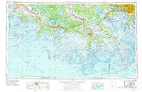
New Orleans, Louisiana, USGS topographic map dated 1963.
Includes geographic coordinates (latitude and longitude). This topographic map is suitable for hiking, camping, and exploring, or framing it as a wall map.
Printed on-demand using high resolution imagery, on heavy weight and acid free paper, or alternatively on a variety of synthetic materials.
Topos available on paper, Waterproof, Poly, or Tyvek. Usually shipping rolled, unless combined with other folded maps in one order.
- Product Number: USGS-5595186
- Free digital map download (high-resolution, GeoPDF): New Orleans, Louisiana (file size: 22 MB)
- Map Size: please refer to the dimensions of the GeoPDF map above
- Weight (paper map): ca. 55 grams
- Map Type: POD USGS Topographic Map
- Map Series: HTMC
- Map Verison: Historical
- Cell ID: 72240
- Scan ID: 335224
- Imprint Year: 1974
- Woodland Tint: Yes
- Aerial Photo Year: 1970
- Edit Year: 1972
- Field Check Year: 1963
- Datum: Unstated
- Map Projection: Transverse Mercator
- Planimetric: Yes
- Map published by United States Army
- Map Language: English
- Scanner Resolution: 600 dpi
- Map Cell Name: New Orleans
- Grid size: 1 X 2 Degree
- Date on map: 1963
- Map Scale: 1:250000
- Geographical region: Louisiana, United States
Neighboring Maps:
All neighboring USGS topo maps are available for sale online at a variety of scales.
Spatial coverage:
Topo map New Orleans, Louisiana, covers the geographical area associated the following places:
- Loquer (historical) - Lyons - Gordy - Poufette - Four Corners - Saint Thomas - Wyandotte - Gloria - Sarah Plantation - Verdunville - Fairfax - Zacarter - Valentine - Capri Court Mobile Home Park - Place De Concorde - Fairville - Wills Point - Timberlane - Norco - Fairlane - Greenwood Acres - Luling - Lafayette (historical) - Luke Landing - Morvant - Bayou Vista - Grand Bayou Mobile Home Park - Saint James - Bonvillain - Landry - Chegby - Attakapas Landing - Cypress Gardens - Lower Vacherie - Port of Iberia - Lockport - L T Plantation - Ludevine - Harvey - Camardelle - Mandalay - Foley - Glenwood - Southdown - Avondale - Beaujolais - Home Place - Fish Island - Prospect - Elmer - Plantation Acres - Marguerite - Ellington - Theriot - Gibson - Grandbois - Katy - Church Spur - Burns - South Kenner - Rex Trailer Court - United - Harahan Junction - Brandywine - Oak Ridge Park - Dennison - Bertie - Kellogg - Arabi - Carte Rouge - Brusle Saint Vincent - Upper Texas - Ramos - Hubertville - Crest Trailer Park - Waverly Mobile Home Park - Faubourg Marigny - Clovelly Farms - Woodmere - Laurel Grove - Ravenwood (historical) - Leche - Oak Park II Mobile Home Park - Bellewood - Remwood Mobile Home Park - Waterproof - Elm Hall Junction - Sunshine - Balco - Carrollton - Lakewood Country Club Estates - Rosedale - Lowlands - Gall - Greig - Lafitte - Caffery - Batree - Carriage Cove Mobile Home Park - Marrero
- Map Area ID: AREA3029-92-90
- Northwest corner Lat/Long code: USGSNW30-92
- Northeast corner Lat/Long code: USGSNE30-90
- Southwest corner Lat/Long code: USGSSW29-92
- Southeast corner Lat/Long code: USGSSE29-90
- Northern map edge Latitude: 30
- Southern map edge Latitude: 29
- Western map edge Longitude: -92
- Eastern map edge Longitude: -90


