
~ New Orleans LA topo map, 1:250000 scale, 1 X 2 Degree, Historical, 1966, updated 1966
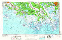
New Orleans, Louisiana, USGS topographic map dated 1966.
Includes geographic coordinates (latitude and longitude). This topographic map is suitable for hiking, camping, and exploring, or framing it as a wall map.
Printed on-demand using high resolution imagery, on heavy weight and acid free paper, or alternatively on a variety of synthetic materials.
Topos available on paper, Waterproof, Poly, or Tyvek. Usually shipping rolled, unless combined with other folded maps in one order.
- Product Number: USGS-5595184
- Free digital map download (high-resolution, GeoPDF): New Orleans, Louisiana (file size: 16 MB)
- Map Size: please refer to the dimensions of the GeoPDF map above
- Weight (paper map): ca. 55 grams
- Map Type: POD USGS Topographic Map
- Map Series: HTMC
- Map Verison: Historical
- Cell ID: 72240
- Scan ID: 335223
- Imprint Year: 1966
- Woodland Tint: Yes
- Aerial Photo Year: 1957
- Field Check Year: 1963
- Datum: Unstated
- Map Projection: Transverse Mercator
- Planimetric: Yes
- Map published by United States Army
- Map Language: English
- Scanner Resolution: 600 dpi
- Map Cell Name: New Orleans
- Grid size: 1 X 2 Degree
- Date on map: 1966
- Map Scale: 1:250000
- Geographical region: Louisiana, United States
Neighboring Maps:
All neighboring USGS topo maps are available for sale online at a variety of scales.
Spatial coverage:
Topo map New Orleans, Louisiana, covers the geographical area associated the following places:
- Oak Alley - Jay - Vallier - Raceland Junction - Wildwood - Enola - Taylors Mobile Home Park - Valentine - McBride - Rienzi Plantation - Davis (historical) - Zacarter - Westfield - Country Boy Mobile Home Park - Davids - Greenwood - Pines Lane Mobile Home Park - Avery Island - Ellington - Labadieville - Caffery - North Vacherie - Avondale - Faleau (historical) - Oak Ridge Park - Frellsen - Kraemer - Ellsworth - Green Acres - Carte Rouge - Mobile Home Park - Plattenville - Poufette - Elm Hall - Melodia Plantation - Cypremort Point - Mathews - Cheniere Caminada - Hope - Woodlawn - Brule - Pecan Grove (historical) - Gheens - Port Fourchon - Saint Rose - Golden Star Plantation - Montegut - Dumesnil - Rex Trailer Court - Boutte - Bon Secours Plantation - Crozier - Linwood - Woodlawn - Cut Off - Chacahoula - Saint Charles - Lapeyrouse - Bellemeade - Jeanerette - Ingleside - Chackbay - Garden City - Rost - Amelia - Pesson - Bayou Crab - Greenwood - Greenwood Acres - Star - Garden District - Upper Texas - Willswood - Mechanicville - Greewood Plantation - Remwood Mobile Home Park - Sandager - Kellogg - Sellers - Avoca - Woodland Heights Mobile Home Community - Solars Mobile Home Park - Crescent - Augusta - Fairlane - Bourgeois Landing - Concession - Beverly Knoll - Shadyside - Gall - Harvey - Woodlawn - Bob Acres - Saint James Plantation - Terrytown - Morgan City Beach - Dwight Fields - Laurel Grove Plantation - Ivanhoe - Raceland
- Map Area ID: AREA3029-92-90
- Northwest corner Lat/Long code: USGSNW30-92
- Northeast corner Lat/Long code: USGSNE30-90
- Southwest corner Lat/Long code: USGSSW29-92
- Southeast corner Lat/Long code: USGSSE29-90
- Northern map edge Latitude: 30
- Southern map edge Latitude: 29
- Western map edge Longitude: -92
- Eastern map edge Longitude: -90


