
~ New Orleans LA topo map, 1:250000 scale, 1 X 2 Degree, Historical, 1963, updated 1963
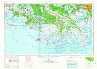
New Orleans, Louisiana, USGS topographic map dated 1963.
Includes geographic coordinates (latitude and longitude). This topographic map is suitable for hiking, camping, and exploring, or framing it as a wall map.
Printed on-demand using high resolution imagery, on heavy weight and acid free paper, or alternatively on a variety of synthetic materials.
Topos available on paper, Waterproof, Poly, or Tyvek. Usually shipping rolled, unless combined with other folded maps in one order.
- Product Number: USGS-5595182
- Free digital map download (high-resolution, GeoPDF): New Orleans, Louisiana (file size: 16 MB)
- Map Size: please refer to the dimensions of the GeoPDF map above
- Weight (paper map): ca. 55 grams
- Map Type: POD USGS Topographic Map
- Map Series: HTMC
- Map Verison: Historical
- Cell ID: 72240
- Scan ID: 335222
- Imprint Year: 1963
- Woodland Tint: Yes
- Aerial Photo Year: 1945
- Datum: NAD27
- Map Projection: Transverse Mercator
- Planimetric: Yes
- Map published by United States Army
- Map Language: English
- Scanner Resolution: 600 dpi
- Map Cell Name: New Orleans
- Grid size: 1 X 2 Degree
- Date on map: 1963
- Map Scale: 1:250000
- Geographical region: Louisiana, United States
Neighboring Maps:
All neighboring USGS topo maps are available for sale online at a variety of scales.
Spatial coverage:
Topo map New Orleans, Louisiana, covers the geographical area associated the following places:
- Brien's Mobile Village - Davids - Saint Rose - Jefferson - Laurel Grove Plantation - Waggaman - Dulac - Glencoe - Ludevine - Bull Run - Lifenite - Oaklawn - Pikes Peak - Waterproof - Woodmere - Melodia Plantation - Acadia - Zacarter - Willswood - Floyd Court Mobile Home Park - Lone Star - Nicholas - Lapeyrouse - Katy - Green Acres - Gold Mine - Ursa - M and T Mobile Home Park - Ramos - Sarah Plantation - Fish Island - Brule - Freetown - Landry - Lower Texas - Southdown Plantation - Marguerite - Sterling - South Kenner - Caire - Dixie Plantation - Berwick - Balco - Lewistown - Ardoyne - Patterson - Kraemer - Clotilda - Lagan - Vieux Carre - Mobile Home Park - Dufresne - Amelia - Delaware - Oakshire Manor - Harahan - Bowie - Oxford - Live Oak - Davis Plantation - Dennison - Faubourg Marigny - Donner - Bayou Cane - Terrytown - Bayou Boeuf - Promised Land - Poufette - Greenwood - Rex Trailer Court - Gibson - Olivier - Greenville - Flagville - Whispering Oaks Mobile Home and Recreational Vehicle Park - Cancienne - Mott Trailer Park - Pierre Part - Verdunville - Hope - Abby Plantation - Luke Landing - Bayou Geneve - McLeod - Arabi - Oak Ridge Park - Savoie - Waterford - Jean Lafitte - Rita - Lockport Heights - Camardelle - Laurel Grove - Kennedy Heights - Faith Trailer Court - Cypremort - Ashland - Shrewsbury - Iberia Mobile Home Park - Linwood
- Map Area ID: AREA3029-92-90
- Northwest corner Lat/Long code: USGSNW30-92
- Northeast corner Lat/Long code: USGSNE30-90
- Southwest corner Lat/Long code: USGSSW29-92
- Southeast corner Lat/Long code: USGSSE29-90
- Northern map edge Latitude: 30
- Southern map edge Latitude: 29
- Western map edge Longitude: -92
- Eastern map edge Longitude: -90


