
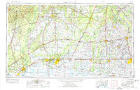
~ Lake Charles LA topo map, 1:250000 scale, 1 X 2 Degree, Historical, 1954, updated 1975
Lake Charles, Louisiana, USGS topographic map dated 1954.
Includes geographic coordinates (latitude and longitude). This topographic map is suitable for hiking, camping, and exploring, or framing it as a wall map.
Printed on-demand using high resolution imagery, on heavy weight and acid free paper, or alternatively on a variety of synthetic materials.
Topos available on paper, Waterproof, Poly, or Tyvek. Usually shipping rolled, unless combined with other folded maps in one order.
- Product Number: USGS-5595176
- Free digital map download (high-resolution, GeoPDF): Lake Charles, Louisiana (file size: 18 MB)
- Map Size: please refer to the dimensions of the GeoPDF map above
- Weight (paper map): ca. 55 grams
- Map Type: POD USGS Topographic Map
- Map Series: HTMC
- Map Verison: Historical
- Cell ID: 68865
- Scan ID: 335219
- Imprint Year: 1975
- Woodland Tint: Yes
- Aerial Photo Year: 1952
- Edit Year: 1972
- Field Check Year: 1954
- Datum: Unstated
- Map Projection: Transverse Mercator
- Map published by United States Army
- Map Language: English
- Scanner Resolution: 600 dpi
- Map Cell Name: Lake Charles
- Grid size: 1 X 2 Degree
- Date on map: 1954
- Map Scale: 1:250000
- Geographical region: Louisiana, United States
Neighboring Maps:
All neighboring USGS topo maps are available for sale online at a variety of scales.
Spatial coverage:
Topo map Lake Charles, Louisiana, covers the geographical area associated the following places:
- F and F Mobile Home Park - Deats (historical) - Lacassine - Lunita - Whiteville - Pinewood - Shankleville - Ebenezer - McNary - Reids - Nezpique - Clifton Mobile Home Park - Golden Acres Mobile Home Park - Evangeline - Fulton - Salem - High School Park - Robertson - Broadmoor - Chappel (historical) - Macland - Richmond Estates Mobile Home Park - Ben's Mobile Home Park - Vinton - Lyons Point - McCutchen Mobile Home Haven - Gravel Point - Flanders - Frilot Cove - La Roulette Mobile Home Park - Tecos Mobile Home Park - Tulla - Toomey - Twin Oaks Mobile Home Park - Belfield - Call - Turps - Clubhouse Landing - Pine Grove - Pine Grove - Fullerton - Rose Bluff - Grand Lake - Fenton - Oakdale - Call Junction - Smittys Mobile Home Park - Westlake - Evangeline Trailer Park - Scott - Sunrise Mobile Home Park - Coe (historical) - Blue Lake Landing - Country Village Mobile Home Park - Jamestown - Omo (historical) - Hartburg - Junction - Lewisburg - Prudhomme - Oretta - Evergreen Estates Mobile Home Park - Garland - Blankenship Mobile Home Park - Redland - Rayne - Mount Dale B Mobile Home Park - Acadian Acres Mobile Home Park - Hacketts Corner - Mystic - Milburn - Cottonport - Cankton - Deweyville - Markee - Hundley - Prairie Laurent - Barber Spur - Indian Bayou - Elder - Cadillac Street Mobile Home Park - Charmon Mobile Home Park - Unatex - Country Air Mobile Home Park - Iowa - Sugarloaf Community Mobile Home Park - Dido - Stringtown - Bundick (historical) - Buckhorn - Laurents Point - Herbert Trailer Park - Quail Ridge Mobile Home Park - Indian Village - Countryside Mobile Home Park - Wiergate - Fairview Recreational Mobile Estates - Panchoville - Eclipse - Airport Mobile Home Park
- Map Area ID: AREA3130-94-92
- Northwest corner Lat/Long code: USGSNW31-94
- Northeast corner Lat/Long code: USGSNE31-92
- Southwest corner Lat/Long code: USGSSW30-94
- Southeast corner Lat/Long code: USGSSE30-92
- Northern map edge Latitude: 31
- Southern map edge Latitude: 30
- Western map edge Longitude: -94
- Eastern map edge Longitude: -92


