
~ Lake Charles LA topo map, 1:250000 scale, 1 X 2 Degree, Historical, 1952
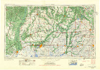
Lake Charles, Louisiana, USGS topographic map dated 1952.
Includes geographic coordinates (latitude and longitude). This topographic map is suitable for hiking, camping, and exploring, or framing it as a wall map.
Printed on-demand using high resolution imagery, on heavy weight and acid free paper, or alternatively on a variety of synthetic materials.
Topos available on paper, Waterproof, Poly, or Tyvek. Usually shipping rolled, unless combined with other folded maps in one order.
- Product Number: USGS-5595172
- Free digital map download (high-resolution, GeoPDF): Lake Charles, Louisiana (file size: 25 MB)
- Map Size: please refer to the dimensions of the GeoPDF map above
- Weight (paper map): ca. 55 grams
- Map Type: POD USGS Topographic Map
- Map Series: HTMC
- Map Verison: Historical
- Cell ID: 68865
- Scan ID: 335217
- Woodland Tint: Yes
- Aerial Photo Year: 1952
- Field Check Year: 1954
- Datum: Unstated
- Map Projection: Transverse Mercator
- Map published by United States Army
- Map Language: English
- Scanner Resolution: 600 dpi
- Map Cell Name: Lake Charles
- Grid size: 1 X 2 Degree
- Date on map: 1952
- Map Scale: 1:250000
- Geographical region: Louisiana, United States
Neighboring Maps:
All neighboring USGS topo maps are available for sale online at a variety of scales.
Spatial coverage:
Topo map Lake Charles, Louisiana, covers the geographical area associated the following places:
- Sutton Junction (historical) - Morse - Richmond Estates Mobile Home Park - Mallard Junction - Johnson Landing - Big Woods - Country Village Mobile Home Park - Mowata - Lewisburg - Gaytine - Barbreck - Glenmora - Bessie Heights - Jesse James Mobile Home Park - McNary - James Mobile Home Park - Shady Acres Mobile Home Park - Cypress Mobile Estates - Le Moyen - Lucas - Airport Mobile Home Park - Kings Court Mobile Home Park - Le Bleu Mobile Home Park - Country Oaks Mobile Home Park - Toomey - Ridgecrest - Mire - Potpourri Village Mobile Home Park - Keystone - Chataignier - Newton - Hebert Mobile Home Park - Chalkley - Moss Bluff - Peach Bloom - Garland - Pine Grove - Boretta - Neame - Bon Air - Grand Prairie - Mulvey - Omo (historical) - La Roulette Mobile Home Park - Evans - Prairieland - Le Bleu - Vermillion Court Mobile Home Park - Lafayette - Shuteston - Gray Point - Leinster - Fontenot - Buna - Junction - Scott - Marionville (historical) - Nitram (historical) - Evergreen - Washington - Illinois Plant - Ridge - Dove Landing - Ben's Mobile Home Park - Roberts Cove - Sugarloaf Community Mobile Home Park - Cole Central - Milton - Fusilier Mobile Home Estates - Whittington Heights Mobile Home Park - Indian Hill Mobile Home Park - A and M Mobile Home Park - DeQuincy - Neale - Bunkie - Coe (historical) - Broussard Mobile Home Park - Davids Trailer and Recreational Vehicle Park - Dossman - Southtowner Mobile Estates - Oilla - Whitehouse - Pine Acres - Paradise Mobile Home Park - Hampton - Pecan Acres Mobile Home Park - Gratis - Leroy - Enterprise - Clubhouse Landing - Vinton - Duralde - Going West Mobile Estates - Bruner - Vatican Square Mobile Village - Angelles Mobile Home Community - Mab - Fullerton - Basile - Thibodeaux Mobile Home Park
- Map Area ID: AREA3130-94-92
- Northwest corner Lat/Long code: USGSNW31-94
- Northeast corner Lat/Long code: USGSNE31-92
- Southwest corner Lat/Long code: USGSSW30-94
- Southeast corner Lat/Long code: USGSSE30-92
- Northern map edge Latitude: 31
- Southern map edge Latitude: 30
- Western map edge Longitude: -94
- Eastern map edge Longitude: -92


