
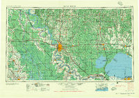
~ Baton Rouge LA topo map, 1:250000 scale, 1 X 2 Degree, Historical, 1956, updated 1956
Baton Rouge, Louisiana, USGS topographic map dated 1956.
Includes geographic coordinates (latitude and longitude). This topographic map is suitable for hiking, camping, and exploring, or framing it as a wall map.
Printed on-demand using high resolution imagery, on heavy weight and acid free paper, or alternatively on a variety of synthetic materials.
Topos available on paper, Waterproof, Poly, or Tyvek. Usually shipping rolled, unless combined with other folded maps in one order.
- Product Number: USGS-5595162
- Free digital map download (high-resolution, GeoPDF): Baton Rouge, Louisiana (file size: 28 MB)
- Map Size: please refer to the dimensions of the GeoPDF map above
- Weight (paper map): ca. 55 grams
- Map Type: POD USGS Topographic Map
- Map Series: HTMC
- Map Verison: Historical
- Cell ID: 68664
- Scan ID: 335208
- Imprint Year: 1956
- Woodland Tint: Yes
- Aerial Photo Year: 1952
- Field Check Year: 1954
- Datum: Unstated
- Map Projection: Transverse Mercator
- Map published by United States Army Corps of Engineers
- Map published by United States Army
- Map Language: English
- Scanner Resolution: 600 dpi
- Map Cell Name: Baton Rouge
- Grid size: 1 X 2 Degree
- Date on map: 1956
- Map Scale: 1:250000
- Geographical region: Louisiana, United States
Neighboring Maps:
All neighboring USGS topo maps are available for sale online at a variety of scales.
Spatial coverage:
Topo map Baton Rouge, Louisiana, covers the geographical area associated the following places:
- Heatherstone - Hazel (historical) - Howell - Lorraine - Riverside Mobile Home Park - Dutch Bayou - Lacour - Wadesboro - Ambrosia (historical) - Evangeline Hermitage Estates - Bonaire - Highland Community - Belfair - Plantation Village Mobile Home Park - Morrison - Seymourville - Haydel (historical) - Wilson - Neita - Enon - Darlington - Brownville (historical) - Frost - Kentwood - Oldfield - Monterrey Park - Quail Hollow - Montz - Buffwood - Port Hudson - Westminster - Lida Grove - Goodwood Estates - Dorcyville - South Sherwood Forest - Immaculata - Catahoula - Magnolia - Nesom (historical) - Hopeville (historical) - The Parks - Waldheim - Windfall - Saint John - Westland Mobile Home Park - Gramercy - Martinville - Winchester - Oxford Place - Teddy - Beacon Hill - Doyle - Loreauville - East Glen - Plains - Gecko - Verdun - Richardson - Georgeville - Folsom - Wind Crest Mobile Home Park - Howell Community Farms - Hollywood - Morganza - Pecan Cove - Burtville - Cinclare - West Lake - Windsor Place - The Myrtles - Tolbert Place - Walet - Twin Oaks Mobile Home Park - Beachwood - Floyd Place - Rougon - Island - Keaty Place - Spanish Fort - Saint Francisville - Velma - Robin - Springhill - Red Oak - Normandy Acres - Hollyridge - Willow Creek - Gonzales - West End - Hillside Mobile Home Park - Woodland Park - Jacoby - Poplar Grove Plantation - S and R Mobile Home Park - Brusly - Duchamp - Henderson - Oneida - Castlewood - Comeaux Mobile Park
- Map Area ID: AREA3130-92-90
- Northwest corner Lat/Long code: USGSNW31-92
- Northeast corner Lat/Long code: USGSNE31-90
- Southwest corner Lat/Long code: USGSSW30-92
- Southeast corner Lat/Long code: USGSSE30-90
- Northern map edge Latitude: 31
- Southern map edge Latitude: 30
- Western map edge Longitude: -92
- Eastern map edge Longitude: -90


