
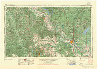
~ Alexandria LA topo map, 1:250000 scale, 1 X 2 Degree, Historical, 1955, updated 1955
Alexandria, Louisiana, USGS topographic map dated 1955.
Includes geographic coordinates (latitude and longitude). This topographic map is suitable for hiking, camping, and exploring, or framing it as a wall map.
Printed on-demand using high resolution imagery, on heavy weight and acid free paper, or alternatively on a variety of synthetic materials.
Topos available on paper, Waterproof, Poly, or Tyvek. Usually shipping rolled, unless combined with other folded maps in one order.
- Product Number: USGS-5595154
- Free digital map download (high-resolution, GeoPDF): Alexandria, Louisiana (file size: 31 MB)
- Map Size: please refer to the dimensions of the GeoPDF map above
- Weight (paper map): ca. 55 grams
- Map Type: POD USGS Topographic Map
- Map Series: HTMC
- Map Verison: Historical
- Cell ID: 68641
- Scan ID: 335204
- Imprint Year: 1955
- Woodland Tint: Yes
- Aerial Photo Year: 1953
- Field Check Year: 1953
- Datum: Unstated
- Map Projection: Transverse Mercator
- Map published by United States Geological Survey
- Map published by United States Army
- Map Language: English
- Scanner Resolution: 600 dpi
- Map Cell Name: Alexandria
- Grid size: 1 X 2 Degree
- Date on map: 1955
- Map Scale: 1:250000
- Geographical region: Louisiana, United States
Neighboring Maps:
All neighboring USGS topo maps are available for sale online at a variety of scales.
Spatial coverage:
Topo map Alexandria, Louisiana, covers the geographical area associated the following places:
- Beech (historical) - Witchwood (historical) - Lee Heights - Clarktown - Yellowpine - Weil - Marco - Timber Trails - Toro - East Hamilton - Fort Buhlow - Sharp Town - Sexton - Old Pleasant Hill - Kimberly Heights - Whispering Pines Estates - Pinegrove (historical) - Barrett - Sandy Hill - Montcla - Nicks (historical) - Deville - Joyce - Richland (historical) - Ringwood - Alfalfa - Grand Ecore - Little Creek - Powhatan - Pineville - Bentley - Rattan - Carla - Patroon - Alco - Dunlap - Highland Acres - Farmland - Pleasant Hill - Ganeyville - The Rock - Hickory Ridge - Bermuda - Libuse - Fort Randolph - Shamrock - Spider (historical) - North Fort Polk - Menefee - Pleasant Hill (historical) - Eden - Union Hill - Sieper - Paradise - Rhinehart - Samtown - Halcyon (historical) - Holloway - Lutes - Fairview Alpha - Fishville - Iatt - Chinquapin Park - Echo - North Point - Walnut Hill - Clyde - McNeely - Slagle - Fisher - Wilson Point - Kent - Center Point - Tower Trailer Park - Alexanders Store - Wises (historical) - Montrose - Mayflower - Woodworth - Leander - Ruby - Creola - Phillips (historical) - Belle d'Eau - Rodemacher - Howcott - Givens (historical) - Blackjack - West Hamilton (historical) - Thomas (historical) - Pickering - Bellwood - Los Adaes (historical) - Oakhill - Hatfield - Logansport - Tower Estates Number 1 - Loyd - Long Bridge - Mount Zion
- Map Area ID: AREA3231-94-92
- Northwest corner Lat/Long code: USGSNW32-94
- Northeast corner Lat/Long code: USGSNE32-92
- Southwest corner Lat/Long code: USGSSW31-94
- Southeast corner Lat/Long code: USGSSE31-92
- Northern map edge Latitude: 32
- Southern map edge Latitude: 31
- Western map edge Longitude: -94
- Eastern map edge Longitude: -92


