
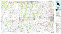
~ Crowley LA topo map, 1:100000 scale, 30 X 60 Minute, Historical, 1985, updated 1988
Crowley, Louisiana, USGS topographic map dated 1985.
Includes geographic coordinates (latitude and longitude). This topographic map is suitable for hiking, camping, and exploring, or framing it as a wall map.
Printed on-demand using high resolution imagery, on heavy weight and acid free paper, or alternatively on a variety of synthetic materials.
Topos available on paper, Waterproof, Poly, or Tyvek. Usually shipping rolled, unless combined with other folded maps in one order.
- Product Number: USGS-5595082
- Free digital map download (high-resolution, GeoPDF): Crowley, Louisiana (file size: 23 MB)
- Map Size: please refer to the dimensions of the GeoPDF map above
- Weight (paper map): ca. 55 grams
- Map Type: POD USGS Topographic Map
- Map Series: HTMC
- Map Verison: Historical
- Cell ID: 67367
- Scan ID: 335165
- Imprint Year: 1988
- Woodland Tint: Yes
- Aerial Photo Year: 1984
- Edit Year: 1985
- Datum: NAD27
- Map Projection: Universal Transverse Mercator
- Map published by United States Geological Survey
- Map Language: English
- Scanner Resolution: 600 dpi
- Map Cell Name: Crowley
- Grid size: 30 X 60 Minute
- Date on map: 1985
- Map Scale: 1:100000
- Geographical region: Louisiana, United States
Neighboring Maps:
All neighboring USGS topo maps are available for sale online at a variety of scales.
Spatial coverage:
Topo map Crowley, Louisiana, covers the geographical area associated the following places:
- Hebert Mobile Home Park - Norberts Golden Gate Mobile Home Park - Clifton Camochahe Mobile Home Park - Veltin - Quiet Living Mobile Home Park - Leleux - Stekey - Benoit Mobile Park - Daves Mobile Home Village - Paradise Mobile Home Park - Crowley - Basile - Bates - Countryside Mobile Home Park - Lauderdale - Rork - Executive Choice Mobile Home Park - Fenton - Judd - Carencro - Ebenezer - Leroy - Holiday Mobile Home Villa Park - Higginbotham - Lake Arthur - Coe (historical) - Shuteston - Verret - Lyons Point - Eunice - Indian Village - Thibodeaux Mobile Home Park - Village Park Mobile Estate - Indian Hill Mobile Home Park - Plauches Little Acres Mobile Home Park - Parkland Mobile Home Park - Laurents Point - Whitehouse - Arceneaux - Ellis - China - Cossinade - Jennings - Charmon Mobile Home Park - Southern Consumer Mobile Home Park - Royal Mobile Home Park - Richard - Acadian Acres Mobile Home Park - Woodlawn - Academy Mobile Village - J and J Mobile Home Park - Guilbeaux (historical) - Lowry - Hayes - Smittys Mobile Home Park - Cajun Mobile Home Village - Arbolada Addition - Maurice - Conques Mobile Home Park - Oriza (historical) - Gravel Point - Redich - Going West Mobile Estates - Mire - Church Point - Potpourri Village Mobile Home Park - Summerwood Mobile Home Community - Shiloh Mobile Home Park - Broadmoor - Carroll Ann Mobile Home Park - Credeur Mobile Home Park - Frey - Hathaway - Meaux - Mobile Home Acres - Flanders - Prudhomme - Roberts Cove - Airport Mobile Home Park - Silverwood - Mulvey - Egan - Angelles Mobile Home Community - Ritchie (historical) - Mr B's Mobile Home Park - Edna - Warren Landry Mobile Home Park - Clifton Mobile Home Park - Tortue - Bristol - Hub Mobile Park - Charon - Welsh - Rayne - Mouton - Tecos Mobile Home Park - Chester Domingue Mobile Home Park - Estherwood - Branch - Country Village Mobile Home Park
- Map Area ID: AREA30.530-93-92
- Northwest corner Lat/Long code: USGSNW30.5-93
- Northeast corner Lat/Long code: USGSNE30.5-92
- Southwest corner Lat/Long code: USGSSW30-93
- Southeast corner Lat/Long code: USGSSE30-92
- Northern map edge Latitude: 30.5
- Southern map edge Latitude: 30
- Western map edge Longitude: -93
- Eastern map edge Longitude: -92


