
~ Thibodaux LA topo map, 1:62500 scale, 15 X 15 Minute, Historical, 1962, updated 1966
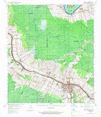
Thibodaux, Louisiana, USGS topographic map dated 1962.
Includes geographic coordinates (latitude and longitude). This topographic map is suitable for hiking, camping, and exploring, or framing it as a wall map.
Printed on-demand using high resolution imagery, on heavy weight and acid free paper, or alternatively on a variety of synthetic materials.
Topos available on paper, Waterproof, Poly, or Tyvek. Usually shipping rolled, unless combined with other folded maps in one order.
- Product Number: USGS-5594922
- Free digital map download (high-resolution, GeoPDF): Thibodaux, Louisiana (file size: 9 MB)
- Map Size: please refer to the dimensions of the GeoPDF map above
- Weight (paper map): ca. 55 grams
- Map Type: POD USGS Topographic Map
- Map Series: HTMC
- Map Verison: Historical
- Cell ID: 63516
- Scan ID: 335071
- Imprint Year: 1966
- Woodland Tint: Yes
- Field Check Year: 1962
- Datum: NAD27
- Map Projection: Polyconic
- Map published by United States Geological Survey
- Map Language: English
- Scanner Resolution: 600 dpi
- Map Cell Name: Thibodaux
- Grid size: 15 X 15 Minute
- Date on map: 1962
- Map Scale: 1:62500
- Geographical region: Louisiana, United States
Neighboring Maps:
All neighboring USGS topo maps are available for sale online at a variety of scales.
Spatial coverage:
Topo map Thibodaux, Louisiana, covers the geographical area associated the following places:
- Freetown - Elmer - Woodlawn - Choupique - Woodland Heights Mobile Home Community - Bessie K - Lafourche - Solars Mobile Home Park - Acadia - Dixie Plantation - Chegby - Rosedale - Twelve Cedars - Orange Grove Plantation - Coulon Plantation - Elmfield - Lowlands - Plantation Acres - Waverly Mobile Home Park - Brule - Batree - Cedar Grove Plantation - Grand Bayou Mobile Home Park - Chula - Chackbay - Pikes Peak - Oak Alley - Abby Plantation - Ingleside - Bertie - Albemarle - Georgia - Labadieville - Brandywine - Caire - Greewood Plantation - Bon Secours Plantation - Laurel Ridge Plantation - Himalaya - Naquin - Saint James Plantation - Laurel Grove - Saint Rose Plantation - Johnson Ridge - Thibodaux Junction - Taylors Mobile Home Park - L T Plantation - Chopin (historical) - Supreme - White Plantation - Greenwood Acres - Saint James - Lagan - Acadian Villa - Leche - Thibodaux - Madewood - Beaujolais - Rienzi Plantation - Leighton - Laurel Grove Plantation - Brule - Laurel Valley Plantation - Morvant
- Map Area ID: AREA3029.75-91-90.75
- Northwest corner Lat/Long code: USGSNW30-91
- Northeast corner Lat/Long code: USGSNE30-90.75
- Southwest corner Lat/Long code: USGSSW29.75-91
- Southeast corner Lat/Long code: USGSSE29.75-90.75
- Northern map edge Latitude: 30
- Southern map edge Latitude: 29.75
- Western map edge Longitude: -91
- Eastern map edge Longitude: -90.75


