
~ Oyster Bayou LA topo map, 1:62500 scale, 15 X 15 Minute, Historical, 1957, updated 1957
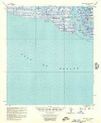
Oyster Bayou, Louisiana, USGS topographic map dated 1957.
Includes geographic coordinates (latitude and longitude). This topographic map is suitable for hiking, camping, and exploring, or framing it as a wall map.
Printed on-demand using high resolution imagery, on heavy weight and acid free paper, or alternatively on a variety of synthetic materials.
Topos available on paper, Waterproof, Poly, or Tyvek. Usually shipping rolled, unless combined with other folded maps in one order.
- Product Number: USGS-5594632
- Free digital map download (high-resolution, GeoPDF): Oyster Bayou, Louisiana (file size: 5 MB)
- Map Size: please refer to the dimensions of the GeoPDF map above
- Weight (paper map): ca. 55 grams
- Map Type: POD USGS Topographic Map
- Map Series: HTMC
- Map Verison: Historical
- Cell ID: 60680
- Scan ID: 334898
- Imprint Year: 1957
- Aerial Photo Year: 1955
- Datum: NAD27
- Map Projection: Polyconic
- Map published by United States Army Corps of Engineers
- Map Language: English
- Scanner Resolution: 600 dpi
- Map Cell Name: Oyster Bayou
- Grid size: 15 X 15 Minute
- Date on map: 1957
- Map Scale: 1:62500
- Geographical region: Louisiana, United States
Neighboring Maps:
All neighboring USGS topo maps are available for sale online at a variety of scales.
Spatial coverage:
Topo map Oyster Bayou, Louisiana, covers the geographical area associated the following places:
- Little Hellhole Bayou - Mudhole Bayou - Bay Castagnier - Hellhole Bay - Bayou Goreau - Old Oyster Bayou Lake - Taylors Bayou - Indian Pass - East Bay Junop - Jack Stout Bayou - Oyster Bayou Lighthouse - Cross Bayou - Bay Banan - Bayou Charbon - Vouvia Bayou - Pelican Pass - Bayou De West - Rat Bayou - Pelican Island - Mudhole Bay - Bay Junop Oil and Gas Field - Tony Bayou - Hellhole Bayou - Jack Stout Bay - Proveausal Bay - Bay Junop - Oyster Bayou - Big Hellhole Lake - Tony Lake - Bayou Banan - Indian Bay
- Map Area ID: AREA29.2529-91.25-91
- Northwest corner Lat/Long code: USGSNW29.25-91.25
- Northeast corner Lat/Long code: USGSNE29.25-91
- Southwest corner Lat/Long code: USGSSW29-91.25
- Southeast corner Lat/Long code: USGSSE29-91
- Northern map edge Latitude: 29.25
- Southern map edge Latitude: 29
- Western map edge Longitude: -91.25
- Eastern map edge Longitude: -91


