
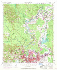
~ Monroe North LA topo map, 1:62500 scale, 15 X 15 Minute, Historical, 1969, updated 1969
Monroe North, Louisiana, USGS topographic map dated 1969.
Includes geographic coordinates (latitude and longitude). This topographic map is suitable for hiking, camping, and exploring, or framing it as a wall map.
Printed on-demand using high resolution imagery, on heavy weight and acid free paper, or alternatively on a variety of synthetic materials.
Topos available on paper, Waterproof, Poly, or Tyvek. Usually shipping rolled, unless combined with other folded maps in one order.
- Product Number: USGS-5594476
- Free digital map download (high-resolution, GeoPDF): Monroe North, Louisiana (file size: 9 MB)
- Map Size: please refer to the dimensions of the GeoPDF map above
- Weight (paper map): ca. 55 grams
- Map Type: POD USGS Topographic Map
- Map Series: HTMC
- Map Verison: Historical
- Cell ID: 57792
- Scan ID: 334809
- Imprint Year: 1969
- Woodland Tint: Yes
- Photo Revision Year: 1969
- Aerial Photo Year: 1969
- Survey Year: 1957
- Datum: NAD27
- Map Projection: Polyconic
- Map published by United States Geological Survey
- Map Language: English
- Scanner Resolution: 600 dpi
- Map Cell Name: Monroe North
- Grid size: 15 X 15 Minute
- Date on map: 1969
- Map Scale: 1:62500
- Geographical region: Louisiana, United States
Neighboring Maps:
All neighboring USGS topo maps are available for sale online at a variety of scales.
Spatial coverage:
Topo map Monroe North, Louisiana, covers the geographical area associated the following places:
- Cargas - Northwood Estates - Dopson - Fish Creek - Northpark Village - Town and Country - Frizzell Spur - West Sterlington - Old Ten - Pine Grove - D'Arbonne Hills - Hammock - Crosley - Rocky Branch - Pecan Bayou - Northgate - Lakeshore - Pine Hollow Estates - Cheniere - River Oaks - Parkwood - Edgewater - Chauvin Estates - Tupawek - De Siard - Sterlington - Ouachita City - Fowler - Shenandoah - Kline - Monroe - Hillside Park - Sunshine Heights - Lamkin - Kiroli Woods - West Monroe - Guthrie - Valley Hills - Sylvan Lake Estates - Lakeland Gardens - Cypress Point - Green Springs - Sicard - Colsons (historical) - Forest Home - Indian Lake Estates - Casa Linda - Breard - Highland Park - Sherwood Forest - Northside Terrace - Suburban North - Lakeview Park - North Monroe - Fairbanks - Oliver - Claiborne - Leisure Village - Forest Park - Port Union (historical) - Western Hills - Pine Terrace - County Side - Royal Pines - Belle Meade - Loch Lomond - Drew - Wall Lake - Perryville - Spanish City - Spencer - Treasure Island - Rockthrow - Crossroads
- Map Area ID: AREA32.7532.5-92.25-92
- Northwest corner Lat/Long code: USGSNW32.75-92.25
- Northeast corner Lat/Long code: USGSNE32.75-92
- Southwest corner Lat/Long code: USGSSW32.5-92.25
- Southeast corner Lat/Long code: USGSSE32.5-92
- Northern map edge Latitude: 32.75
- Southern map edge Latitude: 32.5
- Western map edge Longitude: -92.25
- Eastern map edge Longitude: -92


