
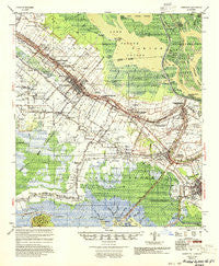
~ Jeanerette LA topo map, 1:62500 scale, 15 X 15 Minute, Historical, 1954, updated 1954
Jeanerette, Louisiana, USGS topographic map dated 1954.
Includes geographic coordinates (latitude and longitude). This topographic map is suitable for hiking, camping, and exploring, or framing it as a wall map.
Printed on-demand using high resolution imagery, on heavy weight and acid free paper, or alternatively on a variety of synthetic materials.
Topos available on paper, Waterproof, Poly, or Tyvek. Usually shipping rolled, unless combined with other folded maps in one order.
- Product Number: USGS-5594226
- Free digital map download (high-resolution, GeoPDF): Jeanerette, Louisiana (file size: 9 MB)
- Map Size: please refer to the dimensions of the GeoPDF map above
- Weight (paper map): ca. 55 grams
- Map Type: POD USGS Topographic Map
- Map Series: HTMC
- Map Verison: Historical
- Cell ID: 55862
- Scan ID: 334666
- Imprint Year: 1954
- Woodland Tint: Yes
- Aerial Photo Year: 1952
- Field Check Year: 1951
- Datum: NAD27
- Map Projection: Polyconic
- Map published by United States Army Corps of Engineers
- Map Language: English
- Scanner Resolution: 600 dpi
- Map Cell Name: Jeanerette
- Grid size: 15 X 15 Minute
- Date on map: 1954
- Map Scale: 1:62500
- Geographical region: Louisiana, United States
Neighboring Maps:
All neighboring USGS topo maps are available for sale online at a variety of scales.
Spatial coverage:
Topo map Jeanerette, Louisiana, covers the geographical area associated the following places:
- Sandager - Fish Island - Kemper - Deslatte - Linwood - Gahn - Loisel - Netpinunsh (historical) - Marguerite - Glencoe - Julien - Lifenite - Bonvillain - Franklin - Bodin - Farmers - Dumesnil - Boudreaux's Mobile Home Park - Ashton - Sorrel - Landry - Home Place - Adeline - Florence - Ivanhoe - Caneland - Katy - Richard - Bourgeois Landing - Fredericks Mobile Home Park - Gold Mine - Rodriquez - Matilda - Richland - Four Corners - Jeanerette - Masters - Prevost - Hope - Baldwin - Kilgore Plantation - Hubertville - Lyons - Choupique - Freetown - Patoutville - Charenton - Violas Mobile Home Park - United
- Map Area ID: AREA3029.75-91.75-91.5
- Northwest corner Lat/Long code: USGSNW30-91.75
- Northeast corner Lat/Long code: USGSNE30-91.5
- Southwest corner Lat/Long code: USGSSW29.75-91.75
- Southeast corner Lat/Long code: USGSSE29.75-91.5
- Northern map edge Latitude: 30
- Southern map edge Latitude: 29.75
- Western map edge Longitude: -91.75
- Eastern map edge Longitude: -91.5


