
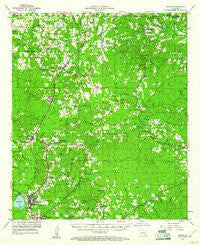
~ Hodge LA topo map, 1:62500 scale, 15 X 15 Minute, Historical, 1953, updated 1961
Hodge, Louisiana, USGS topographic map dated 1953.
Includes geographic coordinates (latitude and longitude). This topographic map is suitable for hiking, camping, and exploring, or framing it as a wall map.
Printed on-demand using high resolution imagery, on heavy weight and acid free paper, or alternatively on a variety of synthetic materials.
Topos available on paper, Waterproof, Poly, or Tyvek. Usually shipping rolled, unless combined with other folded maps in one order.
- Product Number: USGS-5594174
- Free digital map download (high-resolution, GeoPDF): Hodge, Louisiana (file size: 9 MB)
- Map Size: please refer to the dimensions of the GeoPDF map above
- Weight (paper map): ca. 55 grams
- Map Type: POD USGS Topographic Map
- Map Series: HTMC
- Map Verison: Historical
- Cell ID: 55368
- Scan ID: 334639
- Imprint Year: 1961
- Woodland Tint: Yes
- Aerial Photo Year: 1949
- Survey Year: 1953
- Datum: NAD27
- Map Projection: Polyconic
- Map published by United States Geological Survey
- Map Language: English
- Scanner Resolution: 600 dpi
- Map Cell Name: Hodge
- Grid size: 15 X 15 Minute
- Date on map: 1953
- Map Scale: 1:62500
- Geographical region: Louisiana, United States
Neighboring Maps:
All neighboring USGS topo maps are available for sale online at a variety of scales.
Spatial coverage:
Topo map Hodge, Louisiana, covers the geographical area associated the following places:
- Oak Ridge - Pleasant Hill - Woodville - Bonner (historical) - Mount Zion (historical) - Punkin Center - North Hodge - Quitman - Longstraw - Hebron - Saint Claire - Clay - Shull (historical) - Ansley - Ebenzer - Hilltop - Rockfield - Hodge - Redwine (historical) - Vernon - Antioch - East Hodge - Beech Springs - Kelleys - Saint Rest
- Map Area ID: AREA32.532.25-92.75-92.5
- Northwest corner Lat/Long code: USGSNW32.5-92.75
- Northeast corner Lat/Long code: USGSNE32.5-92.5
- Southwest corner Lat/Long code: USGSSW32.25-92.75
- Southeast corner Lat/Long code: USGSSE32.25-92.5
- Northern map edge Latitude: 32.5
- Southern map edge Latitude: 32.25
- Western map edge Longitude: -92.75
- Eastern map edge Longitude: -92.5


