
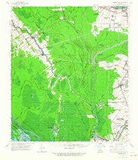
~ Grosse Tete LA topo map, 1:62500 scale, 15 X 15 Minute, Historical, 1962, updated 1965
Grosse Tete, Louisiana, USGS topographic map dated 1962.
Includes geographic coordinates (latitude and longitude). This topographic map is suitable for hiking, camping, and exploring, or framing it as a wall map.
Printed on-demand using high resolution imagery, on heavy weight and acid free paper, or alternatively on a variety of synthetic materials.
Topos available on paper, Waterproof, Poly, or Tyvek. Usually shipping rolled, unless combined with other folded maps in one order.
- Product Number: USGS-5594134
- Free digital map download (high-resolution, GeoPDF): Grosse Tete, Louisiana (file size: 8 MB)
- Map Size: please refer to the dimensions of the GeoPDF map above
- Weight (paper map): ca. 55 grams
- Map Type: POD USGS Topographic Map
- Map Series: HTMC
- Map Verison: Historical
- Cell ID: 54885
- Scan ID: 334615
- Imprint Year: 1965
- Woodland Tint: Yes
- Datum: NAD27
- Map Projection: Polyconic
- Map published by United States Geological Survey
- Map Language: English
- Scanner Resolution: 600 dpi
- Map Cell Name: Grosse Tete
- Grid size: 15 X 15 Minute
- Date on map: 1962
- Map Scale: 1:62500
- Geographical region: Louisiana, United States
Neighboring Maps:
All neighboring USGS topo maps are available for sale online at a variety of scales.
Spatial coverage:
Topo map Grosse Tete, Louisiana, covers the geographical area associated the following places:
- Westover - Lida Grove - Choctaw - Merlin - Choctaw Mobile Home Park - Lynn's Mobile Home Court - Catherine - Wilbert (historical) - Saint Delphine - Myhand Mobile Home Park - Brusly - Lynch - Kahns - S and R Mobile Home Park - Ithra - Webre - Slacks - Catherine - Chenango - Addis - Mark (historical) - Myrtle Grove Plantation - Indian Village - Morley - Lobdell - Rosedale - Lobdell Station - Lejeune - Allendale - Mouchs Mobile Home Park - Grosse Tete - Riverboat Lane Mobile Home Park
- Map Area ID: AREA30.530.25-91.5-91.25
- Northwest corner Lat/Long code: USGSNW30.5-91.5
- Northeast corner Lat/Long code: USGSNE30.5-91.25
- Southwest corner Lat/Long code: USGSSW30.25-91.5
- Southeast corner Lat/Long code: USGSSE30.25-91.25
- Northern map edge Latitude: 30.5
- Southern map edge Latitude: 30.25
- Western map edge Longitude: -91.5
- Eastern map edge Longitude: -91.25


