
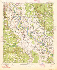
~ Caspiana LA topo map, 1:62500 scale, 15 X 15 Minute, Historical, 1948
Caspiana, Louisiana, USGS topographic map dated 1948.
Includes geographic coordinates (latitude and longitude). This topographic map is suitable for hiking, camping, and exploring, or framing it as a wall map.
Printed on-demand using high resolution imagery, on heavy weight and acid free paper, or alternatively on a variety of synthetic materials.
Topos available on paper, Waterproof, Poly, or Tyvek. Usually shipping rolled, unless combined with other folded maps in one order.
- Product Number: USGS-5593704
- Free digital map download (high-resolution, GeoPDF): Caspiana, Louisiana (file size: 8 MB)
- Map Size: please refer to the dimensions of the GeoPDF map above
- Weight (paper map): ca. 55 grams
- Map Type: POD USGS Topographic Map
- Map Series: HTMC
- Map Verison: Historical
- Cell ID: 52248
- Scan ID: 334352
- Woodland Tint: Yes
- Datum: NAD27
- Map Projection: Polyconic
- Map published by United States Geological Survey
- Map Language: English
- Scanner Resolution: 600 dpi
- Map Cell Name: Caspiana
- Grid size: 15 X 15 Minute
- Date on map: 1948
- Map Scale: 1:62500
- Geographical region: Louisiana, United States
Neighboring Maps:
All neighboring USGS topo maps are available for sale online at a variety of scales.
Spatial coverage:
Topo map Caspiana, Louisiana, covers the geographical area associated the following places:
- Shadow Pine Estates - Woodchuck - Spring Lake Estates - Caplis - Sligo - Magenta - Southgate Estates - West Gate Terrace - Robson - Oakland - Elm Grove - Caspiana - Forbing - Lachute - Morameal - Golden Meadows - Cecile - Ellerbe Road Estates - Moss - Cedar Grove - Wildoak - Palmetto - Curtis - River Oaks - Harwick Place - Pecan Park - Century Park - University Park - Dixie Gardens - Ellerbe Woods - Southgate Estates - Woodstone - Bellaire - River Bend - Aulds (historical) - Taylortown - McDade - Broadmoor Terrace - Palmer Landing - Lucas - Norton - Knot Point - Live Oak - Frierson - Gayles - Southern Gardens - Atkins - Lagas - De Soto (historical) - Mayers - De Broeck Landing - Naylor
- Map Area ID: AREA32.532.25-93.75-93.5
- Northwest corner Lat/Long code: USGSNW32.5-93.75
- Northeast corner Lat/Long code: USGSNE32.5-93.5
- Southwest corner Lat/Long code: USGSSW32.25-93.75
- Southeast corner Lat/Long code: USGSSE32.25-93.5
- Northern map edge Latitude: 32.5
- Southern map edge Latitude: 32.25
- Western map edge Longitude: -93.75
- Eastern map edge Longitude: -93.5


