
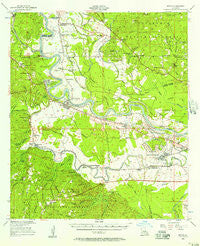
~ Boyce LA topo map, 1:62500 scale, 15 X 15 Minute, Historical, 1956, updated 1957
Boyce, Louisiana, USGS topographic map dated 1956.
Includes geographic coordinates (latitude and longitude). This topographic map is suitable for hiking, camping, and exploring, or framing it as a wall map.
Printed on-demand using high resolution imagery, on heavy weight and acid free paper, or alternatively on a variety of synthetic materials.
Topos available on paper, Waterproof, Poly, or Tyvek. Usually shipping rolled, unless combined with other folded maps in one order.
- Product Number: USGS-5593644
- Free digital map download (high-resolution, GeoPDF): Boyce, Louisiana (file size: 8 MB)
- Map Size: please refer to the dimensions of the GeoPDF map above
- Weight (paper map): ca. 55 grams
- Map Type: POD USGS Topographic Map
- Map Series: HTMC
- Map Verison: Historical
- Cell ID: 51697
- Scan ID: 334314
- Imprint Year: 1957
- Woodland Tint: Yes
- Survey Year: 1942
- Datum: NAD27
- Map Projection: Polyconic
- Map published by United States Geological Survey
- Map published by United States Army Corps of Engineers
- Map Language: English
- Scanner Resolution: 600 dpi
- Map Cell Name: Boyce
- Grid size: 15 X 15 Minute
- Date on map: 1956
- Map Scale: 1:62500
- Geographical region: Louisiana, United States
Neighboring Maps:
All neighboring USGS topo maps are available for sale online at a variety of scales.
Spatial coverage:
Topo map Boyce, Louisiana, covers the geographical area associated the following places:
- Wilda - McNutt - Zimmerman - Ravencamp - Alfalfa - Rock Hill - Rodemacher - Driftwood Trailer Park - Oasis - Milford (historical) - Morris (historical) - Kincaid (historical) - Boyce - Rock - Kateland - Quadrate - Hot Wells - Creola - Gardner - Bagdad - Fairmount - Barrett - Santiago (historical) - Rapides - Weil - Graham (historical) - Mead (historical) - Crane - Magnolia Park
- Map Area ID: AREA31.531.25-92.75-92.5
- Northwest corner Lat/Long code: USGSNW31.5-92.75
- Northeast corner Lat/Long code: USGSNE31.5-92.5
- Southwest corner Lat/Long code: USGSSW31.25-92.75
- Southeast corner Lat/Long code: USGSSE31.25-92.5
- Northern map edge Latitude: 31.5
- Southern map edge Latitude: 31.25
- Western map edge Longitude: -92.75
- Eastern map edge Longitude: -92.5


