
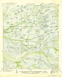
~ Pass A Loutre West LA topo map, 1:31680 scale, 7.5 X 7.5 Minute, Historical, 1947, updated 1947
Pass A Loutre West, Louisiana, USGS topographic map dated 1947.
Includes geographic coordinates (latitude and longitude). This topographic map is suitable for hiking, camping, and exploring, or framing it as a wall map.
Printed on-demand using high resolution imagery, on heavy weight and acid free paper, or alternatively on a variety of synthetic materials.
Topos available on paper, Waterproof, Poly, or Tyvek. Usually shipping rolled, unless combined with other folded maps in one order.
- Product Number: USGS-5593186
- Free digital map download (high-resolution, GeoPDF): Pass A Loutre West, Louisiana (file size: 6 MB)
- Map Size: please refer to the dimensions of the GeoPDF map above
- Weight (paper map): ca. 55 grams
- Map Type: POD USGS Topographic Map
- Map Series: HTMC
- Map Verison: Historical
- Cell ID: 34347
- Scan ID: 334010
- Imprint Year: 1947
- Woodland Tint: Yes
- Field Check Year: 1935
- Datum: NAD27
- Map Projection: Polyconic
- Advance: Yes
- Planimetric: Yes
- Map published by United States Geological Survey
- Map Language: English
- Scanner Resolution: 600 dpi
- Map Cell Name: Pass a Loutre West
- Grid size: 7.5 X 7.5 Minute
- Date on map: 1947
- Map Scale: 1:31680
- Geographical region: Louisiana, United States
Neighboring Maps:
All neighboring USGS topo maps are available for sale online at a variety of scales.
Spatial coverage:
Topo map Pass A Loutre West, Louisiana, covers the geographical area associated the following places:
- Sabot Pond - Mann Outside Pond - Hingle Bend - Fleur Pond - Washington Pond - Brant Bayou - Tilitie Pond - Post Pond - Horseshoe Pond - Willow Pond - Harrys Pond - Son Pond - Paul Morgan Ridge (historical) - John Johnson Bayou - Camps Pond - Mann Inside Pond - Major Inside Pond - Dead Man Bayou - Bastian Lake - Gondle Pond - French Duck Pond - Seagull Pond - Twentyseven Pond - Goose Island Outside Pond - Cheniere Pass - Joe Brown Pass - Adolph Clarks Pond (historical) - Delta Duck Oil Field - Nom Outside Pond - Goat Bayou - Delta National Wildlife Refuge - Woodyard Pond - Bennie Pond - Robinson Pond - Twentyseven Pass - Parry O'Neill Reef - Dave Inside Pond - Alberts Pond - Paddy Bay - Buoy Pond - Japan Island - Bluewing Pond - Big Pond - Lucien Pond - Woodyard Canal (historical) - Bruquiere Pass - Joe Dennis Pond - Dead Women Bend - Octave Pond - Lake Pond - Paul Pond - Goose Island - Martins Pass - Petit Felix Pond - Death Pond - Sprigtail Pond - John Johnson Pond - Goose Island Inside Pass - Cane Pond - Pailleen Queue Pond - Swanson Bayou - Nom Inside Pond - Horse Duck Pond - Morgan Pond - Major Outside Pond - L'Homme Pond - Marion Pass - Round Pond - Little Lake Pond - Club Pond - Dead Women Inside Pond - Pintail Pond - Pass a Loutre - Noms Pass - Maziers Pond - Dead Women Pass - Raphael Pass - Dead Women Outside Pond - Robinson Reef (historical) - Rigaud Ridge (historical) - Jackass Bay - Octave Pass - Dymond Pond - Hingle Pond - Brant Island - Joe Brown Pond - Japan Pass - Bottle Bayou Pond - Little Twentyseven Pond - Coule Pond - Deadman Pond - Mack Pond - Flatboat Inside Pond - Nicholl Pond - Minout Pond - Adolph Pond - Flatboat Outside Pond - Bay Rondo - Dave Outside Pond - Raphael Pass Gas Field
- Map Area ID: AREA29.2529.125-89.25-89.125
- Northwest corner Lat/Long code: USGSNW29.25-89.25
- Northeast corner Lat/Long code: USGSNE29.25-89.125
- Southwest corner Lat/Long code: USGSSW29.125-89.25
- Southeast corner Lat/Long code: USGSSE29.125-89.125
- Northern map edge Latitude: 29.25
- Southern map edge Latitude: 29.125
- Western map edge Longitude: -89.25
- Eastern map edge Longitude: -89.125


