
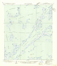
~ Oak Mound Bayou LA topo map, 1:31680 scale, 7.5 X 7.5 Minute, Historical, 1954, updated 1954
Oak Mound Bayou, Louisiana, USGS topographic map dated 1954.
Includes geographic coordinates (latitude and longitude). This topographic map is suitable for hiking, camping, and exploring, or framing it as a wall map.
Printed on-demand using high resolution imagery, on heavy weight and acid free paper, or alternatively on a variety of synthetic materials.
Topos available on paper, Waterproof, Poly, or Tyvek. Usually shipping rolled, unless combined with other folded maps in one order.
- Product Number: USGS-5593164
- Free digital map download (high-resolution, GeoPDF): Oak Mound Bayou, Louisiana (file size: 4 MB)
- Map Size: please refer to the dimensions of the GeoPDF map above
- Weight (paper map): ca. 55 grams
- Map Type: POD USGS Topographic Map
- Map Series: HTMC
- Map Verison: Historical
- Cell ID: 32753
- Scan ID: 333997
- Imprint Year: 1954
- Field Check Year: 1935
- Datum: NAD27
- Map Projection: Polyconic
- Advance: Yes
- Planimetric: Yes
- Map published by United States Geological Survey
- Map Language: English
- Scanner Resolution: 600 dpi
- Map Cell Name: Oak Mound Bayou
- Grid size: 7.5 X 7.5 Minute
- Date on map: 1954
- Map Scale: 1:31680
- Geographical region: Louisiana, United States
Neighboring Maps:
All neighboring USGS topo maps are available for sale online at a variety of scales.
Spatial coverage:
Topo map Oak Mound Bayou, Louisiana, covers the geographical area associated the following places:
- Mud Grass Islands - Lawson Bay - Live Oak Bayou - Bayou Tobacco - Catfish Pass - Kerchimbo Bay - Drum Bay - Dutchman Pass - Conkey Cove - Deadmans Bayou - Conkey Cove Pass - Southwest Pass - Fishing Smack Bay - Hell Pass Coast - Bayou De Soto - Parish Governing Authority District E - Shell Island Lake - Oak Mound Bayou - Bay Boudreau - Anderson Point - Little Mud Grass Islands - Indian Mound Bay - Saint Bernard Parish
- Map Area ID: AREA3029.875-89.375-89.25
- Northwest corner Lat/Long code: USGSNW30-89.375
- Northeast corner Lat/Long code: USGSNE30-89.25
- Southwest corner Lat/Long code: USGSSW29.875-89.375
- Southeast corner Lat/Long code: USGSSE29.875-89.25
- Northern map edge Latitude: 30
- Southern map edge Latitude: 29.875
- Western map edge Longitude: -89.375
- Eastern map edge Longitude: -89.25


