
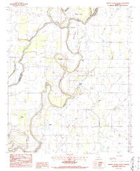
~ Whitney Island South LA topo map, 1:24000 scale, 7.5 X 7.5 Minute, Historical, 1986, updated 1987
Whitney Island South, Louisiana, USGS topographic map dated 1986.
Includes geographic coordinates (latitude and longitude). This topographic map is suitable for hiking, camping, and exploring, or framing it as a wall map.
Printed on-demand using high resolution imagery, on heavy weight and acid free paper, or alternatively on a variety of synthetic materials.
Topos available on paper, Waterproof, Poly, or Tyvek. Usually shipping rolled, unless combined with other folded maps in one order.
- Product Number: USGS-5592422
- Free digital map download (high-resolution, GeoPDF): Whitney Island South, Louisiana (file size: 9 MB)
- Map Size: please refer to the dimensions of the GeoPDF map above
- Weight (paper map): ca. 55 grams
- Map Type: POD USGS Topographic Map
- Map Series: HTMC
- Map Verison: Historical
- Cell ID: 48916
- Scan ID: 333563
- Imprint Year: 1987
- Woodland Tint: Yes
- Aerial Photo Year: 1982
- Edit Year: 1986
- Field Check Year: 1984
- Datum: NAD27
- Map Projection: Lambert Conformal Conic
- Provisional map: Yes
- Map published by United States Geological Survey
- Map Language: English
- Scanner Resolution: 600 dpi
- Map Cell Name: Whitney Island South
- Grid size: 7.5 X 7.5 Minute
- Date on map: 1986
- Map Scale: 1:24000
- Geographical region: Louisiana, United States
Neighboring Maps:
All neighboring USGS topo maps are available for sale online at a variety of scales.
Spatial coverage:
Topo map Whitney Island South, Louisiana, covers the geographical area associated the following places:
- Picketts Island - Morning Star Church - Faith Missionary Church - Cut-off Bayou - Stevenson Cemetery - Old River Island - Parkview Church - Shady Grove Church - Jordan Lake - Lake Lafourche - Balfour Brake - Dabb Bend - Parish Governing Authority District 3 - Friendship Church - Hegwood Bayou - New Zion Church - Scotts Ferry (historical) - Boeuf River Church - Cut-Off Number Two - Antioch Church - Shady Grove Church - Shanks Cemetery - Little Lake - Church of God (historical) - Bayou Bonne Idee - Gum Bayou - Mound Landing - Hegwood Island - Trio Cemetery - Whitney Island - Point Jefferson - Lafourche Cut-off - Bethel Church - West New Home Church - Boggy Bayou - Mercer Brake - Cow Bayou
- Map Area ID: AREA32.62532.5-91.75-91.625
- Northwest corner Lat/Long code: USGSNW32.625-91.75
- Northeast corner Lat/Long code: USGSNE32.625-91.625
- Southwest corner Lat/Long code: USGSSW32.5-91.75
- Southeast corner Lat/Long code: USGSSE32.5-91.625
- Northern map edge Latitude: 32.625
- Southern map edge Latitude: 32.5
- Western map edge Longitude: -91.75
- Eastern map edge Longitude: -91.625


