
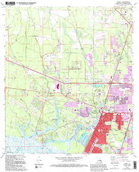
~ Slidell LA topo map, 1:24000 scale, 7.5 X 7.5 Minute, Historical, 1971, updated 1994
Slidell, Louisiana, USGS topographic map dated 1971.
Includes geographic coordinates (latitude and longitude). This topographic map is suitable for hiking, camping, and exploring, or framing it as a wall map.
Printed on-demand using high resolution imagery, on heavy weight and acid free paper, or alternatively on a variety of synthetic materials.
Topos available on paper, Waterproof, Poly, or Tyvek. Usually shipping rolled, unless combined with other folded maps in one order.
- Product Number: USGS-5591880
- Free digital map download (high-resolution, GeoPDF): Slidell, Louisiana (file size: 12 MB)
- Map Size: please refer to the dimensions of the GeoPDF map above
- Weight (paper map): ca. 55 grams
- Map Type: POD USGS Topographic Map
- Map Series: HTMC
- Map Verison: Historical
- Cell ID: 41706
- Scan ID: 333278
- Imprint Year: 1994
- Woodland Tint: Yes
- Photo Revision Year: 1994
- Aerial Photo Year: 1990
- Edit Year: 1994
- Field Check Year: 1971
- Datum: NAD27
- Map Projection: Lambert Conformal Conic
- Map published by United States Geological Survey
- Map Language: English
- Scanner Resolution: 600 dpi
- Map Cell Name: Slidell
- Grid size: 7.5 X 7.5 Minute
- Date on map: 1971
- Map Scale: 1:24000
- Geographical region: Louisiana, United States
Neighboring Maps:
All neighboring USGS topo maps are available for sale online at a variety of scales.
Spatial coverage:
Topo map Slidell, Louisiana, covers the geographical area associated the following places:
- Saint Joe - Salmen - Maude - Regal Park Estates - Oak Ridge - Castle Manor - Hyde Park - Heritage Subdivision - Bayou Liberty Gardens - Oak Manor Estates - Audubon Place Plaza - Huntington Estates - Slidell Ozone Heights - Bayou Oaks - Northwood Village - Bayou Liberty Estates - Brugier - Village North - Park Place - Bayou Bend - Central Park - New Country Club - Bayou Terrace - Noth Forest - Woodlawn Acres - Kings Point - Bayou Vincent - Bonfouca - Royal Estates - Bayou Paquet Estates - North Slidell - Belvedere Estates - Slidell Manor - Delwood - Eastridge - Home Estates - North End - Saint Tammany Garden Meadows - Ozone Woods - Abney Estates - Liberty Acres - Timber Ridge - Whisperwood Estates - Audubon Place - Country Manor - Bon Village - Lakewood - Christi Ann Lea - Ozone Acres - Huntwyck Village - Beverly Hills - Fountain Park - Wimbledon Estates - Bayou Bonfouca Estates - Morgans - Amos - Pine Forest - West Hall Park - Charleston Square - Tanglewood Village - Coin Du Lestin - Lincoln Park - The Woods - Lake Shore Village - Piney Ridge Park - Country Club Estates - Oakwood - Pine Shadows - Carolyn Park - Messer's Mobile Manor - Bayou Vista - Bell Terre Acres - Pinecrest - Beachview - Elysian Acres - Colt - Eagle Lake Mobile Home Park - Fountainbleau - Cadillac Park - Chamale Cove - Forest Manor - Acadian Estates - Broadmoor - Alton - Slidell Heights - Forest Pines - Shady Pines Mobile Home Park - Magnolia Heights - Kimberly Manor - McClane City - Brookwood Estates - Palm Lake - Hermedel - Liberty Pines - Slidell - Oakmont - Browns Village
- Map Area ID: AREA30.37530.25-89.875-89.75
- Northwest corner Lat/Long code: USGSNW30.375-89.875
- Northeast corner Lat/Long code: USGSNE30.375-89.75
- Southwest corner Lat/Long code: USGSSW30.25-89.875
- Southeast corner Lat/Long code: USGSSE30.25-89.75
- Northern map edge Latitude: 30.375
- Southern map edge Latitude: 30.25
- Western map edge Longitude: -89.875
- Eastern map edge Longitude: -89.75


