
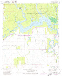
~ Powell Point LA topo map, 1:24000 scale, 7.5 X 7.5 Minute, Historical, 1972, updated 1979
Powell Point, Louisiana, USGS topographic map dated 1972.
Includes geographic coordinates (latitude and longitude). This topographic map is suitable for hiking, camping, and exploring, or framing it as a wall map.
Printed on-demand using high resolution imagery, on heavy weight and acid free paper, or alternatively on a variety of synthetic materials.
Topos available on paper, Waterproof, Poly, or Tyvek. Usually shipping rolled, unless combined with other folded maps in one order.
- Product Number: USGS-5591602
- Free digital map download (high-resolution, GeoPDF): Powell Point, Louisiana (file size: 8 MB)
- Map Size: please refer to the dimensions of the GeoPDF map above
- Weight (paper map): ca. 55 grams
- Map Type: POD USGS Topographic Map
- Map Series: HTMC
- Map Verison: Historical
- Cell ID: 71295
- Scan ID: 333130
- Imprint Year: 1979
- Woodland Tint: Yes
- Photo Revision Year: 1979
- Aerial Photo Year: 1977
- Edit Year: 1979
- Field Check Year: 1972
- Datum: Unstated
- Map Projection: Lambert Conformal Conic
- Map published by United States Geological Survey
- Map Language: English
- Scanner Resolution: 600 dpi
- Map Cell Name: Powell Point
- Grid size: 7.5 X 7.5 Minute
- Date on map: 1972
- Map Scale: 1:24000
- Geographical region: Louisiana, United States
Neighboring Maps:
All neighboring USGS topo maps are available for sale online at a variety of scales.
Spatial coverage:
Topo map Powell Point, Louisiana, covers the geographical area associated the following places:
- Big Saline Bayou - Middle Bayou - Jumping Bayou - Middle Bayou Oil Field - Taylor Bayou - Bushyhead Bayou - Deville Cemetery - Castoff Slough - Racoon Lake (historical) - Big Creek - North Saline Lake Oil Field - Counterfeit Ridge - Jumping Bayou - Big Island Oil Field - Little Bayou Friejon - Vick Oil Field - Muddy Slough - Pointe Saline - Muddy Bayou - Saint Leo Church Oil Field - Nolan Bayou - Big Point - Campright Brake - Horse Island - Camp Branch - Castoff Slough - Old Saline Bayou - Nolans Bayou Oil Field - Shoe Bayou - Horseshoe Lake (historical) - Saline Lake - Camels Slough - Raccoon Bayou - Open Bayou - Big Bayou Friejon - Powell Point - Gum Ridge
- Map Area ID: AREA31.37531.25-92.125-92
- Northwest corner Lat/Long code: USGSNW31.375-92.125
- Northeast corner Lat/Long code: USGSNE31.375-92
- Southwest corner Lat/Long code: USGSSW31.25-92.125
- Southeast corner Lat/Long code: USGSSE31.25-92
- Northern map edge Latitude: 31.375
- Southern map edge Latitude: 31.25
- Western map edge Longitude: -92.125
- Eastern map edge Longitude: -92


