
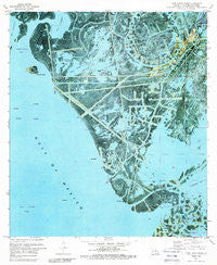
~ Pass Tante Phine LA topo map, 1:24000 scale, 7.5 X 7.5 Minute, Historical, 1971, updated 1989
Pass Tante Phine, Louisiana, USGS topographic map dated 1971.
Includes geographic coordinates (latitude and longitude). This topographic map is suitable for hiking, camping, and exploring, or framing it as a wall map.
Printed on-demand using high resolution imagery, on heavy weight and acid free paper, or alternatively on a variety of synthetic materials.
Topos available on paper, Waterproof, Poly, or Tyvek. Usually shipping rolled, unless combined with other folded maps in one order.
- Product Number: USGS-5591354
- Free digital map download (high-resolution, GeoPDF): Pass Tante Phine, Louisiana (file size: 21 MB)
- Map Size: please refer to the dimensions of the GeoPDF map above
- Weight (paper map): ca. 55 grams
- Map Type: POD USGS Topographic Map
- Map Series: HTMC
- Map Verison: Historical
- Cell ID: 34357
- Scan ID: 332994
- Imprint Year: 1989
- Woodland Tint: Yes
- Aerial Photo Year: 1971
- Survey Year: 1971
- Datum: NAD27
- Map Projection: Polyconic
- Orthophoto: Map
- Map published by United States Geological Survey
- Map Language: English
- Scanner Resolution: 600 dpi
- Map Cell Name: Pass Tante Phine
- Grid size: 7.5 X 7.5 Minute
- Date on map: 1971
- Map Scale: 1:24000
- Geographical region: Louisiana, United States
Neighboring Maps:
All neighboring USGS topo maps are available for sale online at a variety of scales.
Spatial coverage:
Topo map Pass Tante Phine, Louisiana, covers the geographical area associated the following places:
- West Bay Seaplane Base - Parish Governing Authority District 9 - Bog Pond - Pass Tit Francois - Sandy Point - Cane Bayou - Old Spanish Pass - Pass Tante Phine - Venice Canal (historical) - Bayou Alphonse - West Delta Receiving Station Heliport - Bay Tambour - Venice Oil Field - Little Red Pass - Pass de Wharf (historical) - Bayou Alphonse - DGS Heliport - Yankee Pond - Red Pass - West Bay Oil and Gas Field - Sandy Point Bay - Bayou Tony (historical) - Fleur Pond (historical) - Bayou Chawee
- Map Area ID: AREA29.2529.125-89.5-89.375
- Northwest corner Lat/Long code: USGSNW29.25-89.5
- Northeast corner Lat/Long code: USGSNE29.25-89.375
- Southwest corner Lat/Long code: USGSSW29.125-89.5
- Southeast corner Lat/Long code: USGSSE29.125-89.375
- Northern map edge Latitude: 29.25
- Southern map edge Latitude: 29.125
- Western map edge Longitude: -89.5
- Eastern map edge Longitude: -89.375


