
~ New Orleans West LA topo map, 1:24000 scale, 7.5 X 7.5 Minute, Historical, 1998, updated 2000
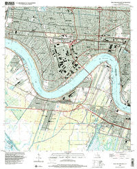
New Orleans West, Louisiana, USGS topographic map dated 1998.
Includes geographic coordinates (latitude and longitude). This topographic map is suitable for hiking, camping, and exploring, or framing it as a wall map.
Printed on-demand using high resolution imagery, on heavy weight and acid free paper, or alternatively on a variety of synthetic materials.
Topos available on paper, Waterproof, Poly, or Tyvek. Usually shipping rolled, unless combined with other folded maps in one order.
- Product Number: USGS-5591192
- Free digital map download (high-resolution, GeoPDF): New Orleans West, Louisiana (file size: 14 MB)
- Map Size: please refer to the dimensions of the GeoPDF map above
- Weight (paper map): ca. 55 grams
- Map Type: POD USGS Topographic Map
- Map Series: HTMC
- Map Verison: Historical
- Cell ID: 31813
- Scan ID: 332911
- Imprint Year: 2000
- Woodland Tint: Yes
- Aerial Photo Year: 1998
- Datum: NAD83
- Map Projection: Universal Transverse Mercator
- Map published by United States Geological Survey
- Map Language: English
- Scanner Resolution: 600 dpi
- Map Cell Name: New Orleans West
- Grid size: 7.5 X 7.5 Minute
- Date on map: 1998
- Map Scale: 1:24000
- Geographical region: Louisiana, United States
Neighboring Maps:
All neighboring USGS topo maps are available for sale online at a variety of scales.
Spatial coverage:
Topo map New Orleans West, Louisiana, covers the geographical area associated the following places:
- Harahan Junction - Oak Ridge Park - Little Farms (historical) - Kenner - Metairie - Beverly Knoll - Orlandos Mobile Home Park - Bridge City - Kennedy Heights - Greenville - Elmwood - Avondale - Westwego - Circle West Mobile Homes Estates - Live Oak Manor - Metairie Terrace - Carrollton - Jefferson - Jefferson Heights - Waggaman - Harahan - Southport - Pricetown (historical) - Shrewsbury - Bonnabel Place - River Ridge - Rex Trailer Court - Willswood
- Map Area ID: AREA3029.875-90.25-90.125
- Northwest corner Lat/Long code: USGSNW30-90.25
- Northeast corner Lat/Long code: USGSNE30-90.125
- Southwest corner Lat/Long code: USGSSW29.875-90.25
- Southeast corner Lat/Long code: USGSSE29.875-90.125
- Northern map edge Latitude: 30
- Southern map edge Latitude: 29.875
- Western map edge Longitude: -90.25
- Eastern map edge Longitude: -90.125


