
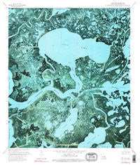
~ Lost Lake LA topo map, 1:24000 scale, 7.5 X 7.5 Minute, Historical, 1974, updated 1976
Lost Lake, Louisiana, USGS topographic map dated 1974.
Includes geographic coordinates (latitude and longitude). This topographic map is suitable for hiking, camping, and exploring, or framing it as a wall map.
Printed on-demand using high resolution imagery, on heavy weight and acid free paper, or alternatively on a variety of synthetic materials.
Topos available on paper, Waterproof, Poly, or Tyvek. Usually shipping rolled, unless combined with other folded maps in one order.
- Product Number: USGS-5590682
- Free digital map download (high-resolution, GeoPDF): Lost Lake, Louisiana (file size: 23 MB)
- Map Size: please refer to the dimensions of the GeoPDF map above
- Weight (paper map): ca. 55 grams
- Map Type: POD USGS Topographic Map
- Map Series: HTMC
- Map Verison: Historical
- Cell ID: 72443
- Scan ID: 332642
- Imprint Year: 1976
- Woodland Tint: Yes
- Visual Version Number: 2
- Photo Inspection Year: 1978
- Aerial Photo Year: 1973
- Survey Year: 1974
- Datum: NAD27
- Map Projection: Lambert Conformal Conic
- Orthophoto: Map
- Map published by United States Geological Survey
- Map Language: English
- Scanner Resolution: 600 dpi
- Map Cell Name: Lost Lake
- Grid size: 7.5 X 7.5 Minute
- Date on map: 1974
- Map Scale: 1:24000
- Geographical region: Louisiana, United States
Neighboring Maps:
All neighboring USGS topo maps are available for sale online at a variety of scales.
Spatial coverage:
Topo map Lost Lake, Louisiana, covers the geographical area associated the following places:
- Schooner Bayou - Bayou New Route - Bayou Chevreau - The Narrows - Violin Bayou - Little Carrion Bayou - Turtle Bayou - Fiddlers Lake - Fiddlers Lake Gas Field - Eagle Bayou - Lost Lake - Buckskin Bayou - Crochet Canal - Plessale Cut - Lost Lake Pass - Big Carencro Bayou - Old Oyster Bayou - Rice Island - Eagle Lake - Bayou Sanbout - Wine Bayou - Blue Hammock Bayou - Bayou Mauvais Bois - Moreau Beaux Bayou - Rice Bayou
- Map Area ID: AREA29.37529.25-91.125-91
- Northwest corner Lat/Long code: USGSNW29.375-91.125
- Northeast corner Lat/Long code: USGSNE29.375-91
- Southwest corner Lat/Long code: USGSSW29.25-91.125
- Southeast corner Lat/Long code: USGSSE29.25-91
- Northern map edge Latitude: 29.375
- Southern map edge Latitude: 29.25
- Western map edge Longitude: -91.125
- Eastern map edge Longitude: -91


