
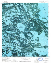
~ Lake Cuatro Caballo LA topo map, 1:24000 scale, 7.5 X 7.5 Minute, Historical, 1973, updated 1992
Lake Cuatro Caballo, Louisiana, USGS topographic map dated 1973.
Includes geographic coordinates (latitude and longitude). This topographic map is suitable for hiking, camping, and exploring, or framing it as a wall map.
Printed on-demand using high resolution imagery, on heavy weight and acid free paper, or alternatively on a variety of synthetic materials.
Topos available on paper, Waterproof, Poly, or Tyvek. Usually shipping rolled, unless combined with other folded maps in one order.
- Product Number: USGS-5590352
- Free digital map download (high-resolution, GeoPDF): Lake Cuatro Caballo, Louisiana (file size: 23 MB)
- Map Size: please refer to the dimensions of the GeoPDF map above
- Weight (paper map): ca. 55 grams
- Map Type: POD USGS Topographic Map
- Map Series: HTMC
- Map Verison: Historical
- Cell ID: 24404
- Scan ID: 332470
- Imprint Year: 1992
- Woodland Tint: Yes
- Photo Revision Year: 1992
- Aerial Photo Year: 1971
- Survey Year: 1973
- Datum: NAD27
- Map Projection: Lambert Conformal Conic
- Orthophoto: Map
- Map published by United States Geological Survey
- Map Language: English
- Scanner Resolution: 600 dpi
- Map Cell Name: Lake Cuatro Caballo
- Grid size: 7.5 X 7.5 Minute
- Date on map: 1973
- Map Scale: 1:24000
- Geographical region: Louisiana, United States
Neighboring Maps:
All neighboring USGS topo maps are available for sale online at a variety of scales.
Spatial coverage:
Topo map Lake Cuatro Caballo, Louisiana, covers the geographical area associated the following places:
- Rat Bayou - Bayou Jean Louis Robin - Bayou Terre Aux Boeufs - Popcorn Bayou - Sister Bayou - Lost Flat Bayou - Lake Campo Pass - Deer Island - Daylight Bay - False River - Lake Cuatro Caballo - Bay of River Aux Chenes - Bay Shallow - Lake Jean Louis Robin - Lake Pato Caballo - Little False River - Deer Island Bayou - Polk and Dallas Bayou - Crooked Bayou Gas Field - Adema Pond - Flat Bayou - Lake John - Sand Hill Bayou - Bayou Menard - Branville Bay - Lost Flat Bay - Petain Lagoon - Pintail Flat - Bayou Ponton - Bottle Lagoon - Bayou Zip - Bayou Fon Gera - Bottle Bayou - Bayou Goudet - Bayou Lingeo - Crooked Bayou - Round Lake - Lake Campo
- Map Area ID: AREA29.7529.625-89.75-89.625
- Northwest corner Lat/Long code: USGSNW29.75-89.75
- Northeast corner Lat/Long code: USGSNE29.75-89.625
- Southwest corner Lat/Long code: USGSSW29.625-89.75
- Southeast corner Lat/Long code: USGSSE29.625-89.625
- Northern map edge Latitude: 29.75
- Southern map edge Latitude: 29.625
- Western map edge Longitude: -89.75
- Eastern map edge Longitude: -89.625


