
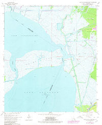
~ Lake Cataouatche East LA topo map, 1:24000 scale, 7.5 X 7.5 Minute, Historical, 1966, updated 1980
Lake Cataouatche East, Louisiana, USGS topographic map dated 1966.
Includes geographic coordinates (latitude and longitude). This topographic map is suitable for hiking, camping, and exploring, or framing it as a wall map.
Printed on-demand using high resolution imagery, on heavy weight and acid free paper, or alternatively on a variety of synthetic materials.
Topos available on paper, Waterproof, Poly, or Tyvek. Usually shipping rolled, unless combined with other folded maps in one order.
- Product Number: USGS-5590302
- Free digital map download (high-resolution, GeoPDF): Lake Cataouatche East, Louisiana (file size: 13 MB)
- Map Size: please refer to the dimensions of the GeoPDF map above
- Weight (paper map): ca. 55 grams
- Map Type: POD USGS Topographic Map
- Map Series: HTMC
- Map Verison: Historical
- Cell ID: 24368
- Scan ID: 332445
- Imprint Year: 1980
- Woodland Tint: Yes
- Photo Revision Year: 1979
- Aerial Photo Year: 1978
- Edit Year: 1979
- Survey Year: 1966
- Datum: NAD27
- Map Projection: Polyconic
- Map published by United States Geological Survey
- Map Language: English
- Scanner Resolution: 600 dpi
- Map Cell Name: Lake Cataouatche East
- Grid size: 7.5 X 7.5 Minute
- Date on map: 1966
- Map Scale: 1:24000
- Geographical region: Louisiana, United States
Neighboring Maps:
All neighboring USGS topo maps are available for sale online at a variety of scales.
Spatial coverage:
Topo map Lake Cataouatche East, Louisiana, covers the geographical area associated the following places:
- Jean Lafitte National Historical Park and Preserve - Couba Island Oil Field - Bayou Villars Oil Field - Couba Island - Bayou Dauphine - Bayou Boeuf - Woods Place Canal - Lake Cataouatche - Avondale Outflow Canal - Kenta Canal - Estelle Canal - Bayou Segnette - Bayou Segnette Waterway - Labranche Canal - WWL-AM (New Orleans) - Bayou Bardeaux - Millaudon Canal - Bayou Couba - Delery Canal - Parish Governing Authority District 3
- Map Area ID: AREA29.87529.75-90.25-90.125
- Northwest corner Lat/Long code: USGSNW29.875-90.25
- Northeast corner Lat/Long code: USGSNE29.875-90.125
- Southwest corner Lat/Long code: USGSSW29.75-90.25
- Southeast corner Lat/Long code: USGSSE29.75-90.125
- Northern map edge Latitude: 29.875
- Southern map edge Latitude: 29.75
- Western map edge Longitude: -90.25
- Eastern map edge Longitude: -90.125


