
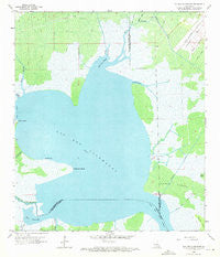
~ Lac Des Allemands LA topo map, 1:24000 scale, 7.5 X 7.5 Minute, Historical, 1962, updated 1971
Lac Des Allemands, Louisiana, USGS topographic map dated 1962.
Includes geographic coordinates (latitude and longitude). This topographic map is suitable for hiking, camping, and exploring, or framing it as a wall map.
Printed on-demand using high resolution imagery, on heavy weight and acid free paper, or alternatively on a variety of synthetic materials.
Topos available on paper, Waterproof, Poly, or Tyvek. Usually shipping rolled, unless combined with other folded maps in one order.
- Product Number: USGS-5590204
- Free digital map download (high-resolution, GeoPDF): Lac Des Allemands, Louisiana (file size: 14 MB)
- Map Size: please refer to the dimensions of the GeoPDF map above
- Weight (paper map): ca. 55 grams
- Map Type: POD USGS Topographic Map
- Map Series: HTMC
- Map Verison: Historical
- Cell ID: 24195
- Scan ID: 332391
- Imprint Year: 1971
- Woodland Tint: Yes
- Aerial Photo Year: 1961
- Survey Year: 1962
- Datum: NAD27
- Map Projection: Polyconic
- Map published by United States Geological Survey
- Map Language: English
- Scanner Resolution: 600 dpi
- Map Cell Name: Lac des Allemands
- Grid size: 7.5 X 7.5 Minute
- Date on map: 1962
- Map Scale: 1:24000
- Geographical region: Louisiana, United States
Neighboring Maps:
All neighboring USGS topo maps are available for sale online at a variety of scales.
Spatial coverage:
Topo map Lac Des Allemands, Louisiana, covers the geographical area associated the following places:
- Bayou Becnel - Pecan Tree Canal - Providence Canal - Lacs Des Atlemands Gas Field - Bayou Chevreuil - Lake Lucy Gas Field - Bayou Boeuf - Pointe Lavin Canal - Lucy Gas Field - Pointe Cypres - Little Pecan Tree Canal - Baie Chevreuil - Baie Des Deux Chenes - Bayou Fortier - Lac des Allemands - Knights Bay Island - Parish Governing Authority District 1 - Fausse Pointe - Bayou Lasseigne - Knight Bay - Pointe aux Herbes - Martin Island Gas Field - Carlin Pointe - Bayou Lassene - Baie a Carlin - Lucy Gas Field - Saint Charles Canal - Baie d'en Haut - Bayou Rond Pompon - Ward Two - Bayou Pain
- Map Area ID: AREA3029.875-90.625-90.5
- Northwest corner Lat/Long code: USGSNW30-90.625
- Northeast corner Lat/Long code: USGSNE30-90.5
- Southwest corner Lat/Long code: USGSSW29.875-90.625
- Southeast corner Lat/Long code: USGSSE29.875-90.5
- Northern map edge Latitude: 30
- Southern map edge Latitude: 29.875
- Western map edge Longitude: -90.625
- Eastern map edge Longitude: -90.5


