
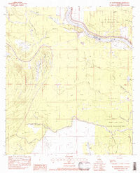
~ Ile Natchitoches LA topo map, 1:24000 scale, 7.5 X 7.5 Minute, Historical, 1982, updated 1983
Ile Natchitoches, Louisiana, USGS topographic map dated 1982.
Includes geographic coordinates (latitude and longitude). This topographic map is suitable for hiking, camping, and exploring, or framing it as a wall map.
Printed on-demand using high resolution imagery, on heavy weight and acid free paper, or alternatively on a variety of synthetic materials.
Topos available on paper, Waterproof, Poly, or Tyvek. Usually shipping rolled, unless combined with other folded maps in one order.
- Product Number: USGS-5589984
- Free digital map download (high-resolution, GeoPDF): Ile Natchitoches, Louisiana (file size: 8 MB)
- Map Size: please refer to the dimensions of the GeoPDF map above
- Weight (paper map): ca. 55 grams
- Map Type: POD USGS Topographic Map
- Map Series: HTMC
- Map Verison: Historical
- Cell ID: 21709
- Scan ID: 332278
- Imprint Year: 1983
- Woodland Tint: Yes
- Aerial Photo Year: 1975
- Edit Year: 1982
- Field Check Year: 1977
- Datum: NAD27
- Map Projection: Lambert Conformal Conic
- Provisional map: Yes
- Map published by United States Geological Survey
- Map Language: English
- Scanner Resolution: 600 dpi
- Map Cell Name: Ile Natchitoches
- Grid size: 7.5 X 7.5 Minute
- Date on map: 1982
- Map Scale: 1:24000
- Geographical region: Louisiana, United States
Neighboring Maps:
All neighboring USGS topo maps are available for sale online at a variety of scales.
Spatial coverage:
Topo map Ile Natchitoches, Louisiana, covers the geographical area associated the following places:
- La Mouilliere - Grassy Lake State Wildlife Management Area - Wolf Prairie - Bayou La Chenière - Grande Coulée - Mauvais Lac - Baie Ronde - Lake Taylor - Threemile Bayou - Bayou Prairie - Bayou Jeansonne - Grand Bayou - Bayou Tortue - Twomile Bayou - Bayou Sans Facon - Lac Long - Bayou des Lances - Lac d' Aigrette - Sixmile Bayou - Lac a Madame Lee - Lac Calebasse - Five Mile Bayou Oil Field - Natchitoches Bayou Oil Field - Pointe Basse - Lac Volee - Bayou des Cyprès - Three Mile Bayou Oil Field - Ile Natchitoches - Catfish Bayou Oil Field - Bayou de L'Isle - Petite Baie - Natchitoches Island Oil Field - Cyprière Gros Bec - Lac Poisson Arme - Milligan Bayou Oil Field
- Map Area ID: AREA31.2531.125-91.875-91.75
- Northwest corner Lat/Long code: USGSNW31.25-91.875
- Northeast corner Lat/Long code: USGSNE31.25-91.75
- Southwest corner Lat/Long code: USGSSW31.125-91.875
- Southeast corner Lat/Long code: USGSSE31.125-91.75
- Northern map edge Latitude: 31.25
- Southern map edge Latitude: 31.125
- Western map edge Longitude: -91.875
- Eastern map edge Longitude: -91.75


