
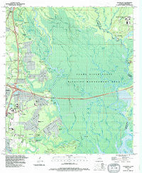
~ Haaswood LA topo map, 1:24000 scale, 7.5 X 7.5 Minute, Historical, 1993, updated 1995
Haaswood, Louisiana, USGS topographic map dated 1993.
Includes geographic coordinates (latitude and longitude). This topographic map is suitable for hiking, camping, and exploring, or framing it as a wall map.
Printed on-demand using high resolution imagery, on heavy weight and acid free paper, or alternatively on a variety of synthetic materials.
Topos available on paper, Waterproof, Poly, or Tyvek. Usually shipping rolled, unless combined with other folded maps in one order.
- Product Number: USGS-5589784
- Free digital map download (high-resolution, GeoPDF): Haaswood, Louisiana (file size: 15 MB)
- Map Size: please refer to the dimensions of the GeoPDF map above
- Weight (paper map): ca. 55 grams
- Map Type: POD USGS Topographic Map
- Map Series: HTMC
- Map Verison: Historical
- Cell ID: 70279
- Scan ID: 332178
- Imprint Year: 1995
- Woodland Tint: Yes
- Visual Version Number: 1
- Aerial Photo Year: 1989
- Edit Year: 1995
- Field Check Year: 1993
- Survey Year: 1959
- Datum: NAD27
- Map Projection: Universal Transverse Mercator
- Map published by United States Geological Survey
- Map Language: English
- Scanner Resolution: 600 dpi
- Map Cell Name: Haaswood
- Grid size: 7.5 X 7.5 Minute
- Date on map: 1993
- Map Scale: 1:24000
- Geographical region: Louisiana, United States
Neighboring Maps:
All neighboring USGS topo maps are available for sale online at a variety of scales.
Spatial coverage:
Topo map Haaswood, Louisiana, covers the geographical area associated the following places:
- Crawford Landing - Haaswood - Bel Air - Southern Manor Mobile Home Park - Robert Park - Quail Ridge - Riverview Addition - Abney Country Air - Twin Oaks Mobile Manor - Pearl Acres - Napoleon - French Branch Estates - Morgan Bluff - Gainesville - Tammany Mobile Home Park - River Gardens - River Oaks - Ozone Pines - Holiday Acres - Porters River Landing - Hickory Hills - Gum Bayou Landing - Country Club Mobile Home Park - Lake Village - Pecan Grove - Foxhollow - Davis Landing - Timber Lake Estates - Magnolia Forest - Willow Wood - Cross Gates - Doubloon Bayou Estates - Rivercrest - Frenchmens Estates - Oak Grove Estates - Lindberg Glen - The Settlement
- Map Area ID: AREA30.37530.25-89.75-89.625
- Northwest corner Lat/Long code: USGSNW30.375-89.75
- Northeast corner Lat/Long code: USGSNE30.375-89.625
- Southwest corner Lat/Long code: USGSSW30.25-89.75
- Southeast corner Lat/Long code: USGSSE30.25-89.625
- Northern map edge Latitude: 30.375
- Southern map edge Latitude: 30.25
- Western map edge Longitude: -89.75
- Eastern map edge Longitude: -89.625


