
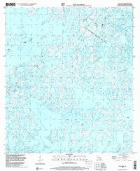
~ Dog Lake LA topo map, 1:24000 scale, 7.5 X 7.5 Minute, Historical, 1998, updated 2001
Dog Lake, Louisiana, USGS topographic map dated 1998.
Includes geographic coordinates (latitude and longitude). This topographic map is suitable for hiking, camping, and exploring, or framing it as a wall map.
Printed on-demand using high resolution imagery, on heavy weight and acid free paper, or alternatively on a variety of synthetic materials.
Topos available on paper, Waterproof, Poly, or Tyvek. Usually shipping rolled, unless combined with other folded maps in one order.
- Product Number: USGS-5589158
- Free digital map download (high-resolution, GeoPDF): Dog Lake, Louisiana (file size: 10 MB)
- Map Size: please refer to the dimensions of the GeoPDF map above
- Weight (paper map): ca. 55 grams
- Map Type: POD USGS Topographic Map
- Map Series: HTMC
- Map Verison: Historical
- Cell ID: 12455
- Scan ID: 331852
- Imprint Year: 2001
- Aerial Photo Year: 1998
- Datum: NAD83
- Map Projection: Universal Transverse Mercator
- Map published by United States Geological Survey
- Map Language: English
- Scanner Resolution: 600 dpi
- Map Cell Name: Dog Lake
- Grid size: 7.5 X 7.5 Minute
- Date on map: 1998
- Map Scale: 1:24000
- Geographical region: Louisiana, United States
Neighboring Maps:
All neighboring USGS topo maps are available for sale online at a variety of scales.
Spatial coverage:
Topo map Dog Lake, Louisiana, covers the geographical area associated the following places:
- Lake Becasse - Bayou Nicholi - Moncleuse Bay - China Island - Bayou John Bop - Pass des Illes - Bayou Grand Caillou - Bay Charlie - Bay de l'Ouest - Big Misale Bayou - Bay de Mongles - Hackberry Lake - Bayou des Illettes - Post Bayou - Salt Bay - Quitman Bayou - Grand Pass des Ilettes - Dog Lake - Four Isle Dome Oil and Gas Field - Bayou Colyell - Petit Pass des Ilettes - Little Misale Bayou - Bayou De L'Ouest - Dog Lake Bayou - Pass des Ilettes - Bayou Rochelle - Bayou Chine - Muskrat Bayou - Trouble Bayou
- Map Area ID: AREA29.2529.125-90.875-90.75
- Northwest corner Lat/Long code: USGSNW29.25-90.875
- Northeast corner Lat/Long code: USGSNE29.25-90.75
- Southwest corner Lat/Long code: USGSSW29.125-90.875
- Southeast corner Lat/Long code: USGSSE29.125-90.75
- Northern map edge Latitude: 29.25
- Southern map edge Latitude: 29.125
- Western map edge Longitude: -90.875
- Eastern map edge Longitude: -90.75


