
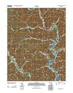
~ Lesterville SE MO topo map, 1:24000 scale, 7.5 X 7.5 Minute, Historical, 2011
Lesterville SE, Missouri, USGS topographic map dated 2011.
Includes geographic coordinates (latitude and longitude). This topographic map is suitable for hiking, camping, and exploring, or framing it as a wall map.
Printed on-demand using high resolution imagery, on heavy weight and acid free paper, or alternatively on a variety of synthetic materials.
Topos available on paper, Waterproof, Poly, or Tyvek. Usually shipping rolled, unless combined with other folded maps in one order.
- Product Number: USGS-5584104
- Free digital map download (high-resolution, GeoPDF): Lesterville SE, Missouri (file size: 30 MB)
- Map Size: please refer to the dimensions of the GeoPDF map above
- Weight (paper map): ca. 55 grams
- Map Type: POD USGS Topographic Map
- Map Series: US Topo
- Map Verison: Historical
- Cell ID: 25505
- Datum: North American Datum of 1983
- Map Projection: Transverse Mercator
- Map Cell Name: Lesterville SE
- Grid size: 7.5 X 7.5 Minute
- Date on map: 2011
- Map Scale: 1:24000
- Geographical region: Missouri, United States
Neighboring Maps:
All neighboring USGS topo maps are available for sale online at a variety of scales.
Spatial coverage:
Topo map Lesterville SE, Missouri, covers the geographical area associated the following places:
- Wet Hollow - Shed School (historical) - Highway K Public Use Area - Carpenter Hollow - Sycamore Hollow - Whizenhunt Bay - Colyotte Hollow - Gulliams Cemetery - Bear Branch - Bolch Hollow - Lewis Cemetery - Rutter Cemetery - Hampton Cemetery - Mann Cemetery - Funk Branch Wilderness Camping Site - Martha (historical) - Carpenter Cemetery - Mayberry Branch - Cave Spring - Whizenhunt Hollow - Boyd Hollow - Mayberry School - Brawley Hollow - Baker Pond - Dafron Hollow - Hyatts Creek - Goose Creek - Champion Spring Branch - Pyrtle Hollow - Raucom School (historical) - Wet Hollow - Funk Branch - Pyles Hollow - Hackworth Hollow - Well Hollow - Murphy Cemetery - Martha Post Office (historical) - Low Hollow - Leonards Lake
- Map Area ID: AREA37.37537.25-90.875-90.75
- Northwest corner Lat/Long code: USGSNW37.375-90.875
- Northeast corner Lat/Long code: USGSNE37.375-90.75
- Southwest corner Lat/Long code: USGSSW37.25-90.875
- Southeast corner Lat/Long code: USGSSE37.25-90.75
- Northern map edge Latitude: 37.375
- Southern map edge Latitude: 37.25
- Western map edge Longitude: -90.875
- Eastern map edge Longitude: -90.75


