
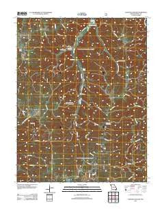
~ Kaintuck Hollow MO topo map, 1:24000 scale, 7.5 X 7.5 Minute, Historical, 2011
Kaintuck Hollow, Missouri, USGS topographic map dated 2011.
Includes geographic coordinates (latitude and longitude). This topographic map is suitable for hiking, camping, and exploring, or framing it as a wall map.
Printed on-demand using high resolution imagery, on heavy weight and acid free paper, or alternatively on a variety of synthetic materials.
Topos available on paper, Waterproof, Poly, or Tyvek. Usually shipping rolled, unless combined with other folded maps in one order.
- Product Number: USGS-5582104
- Free digital map download (high-resolution, GeoPDF): Kaintuck Hollow, Missouri (file size: 29 MB)
- Map Size: please refer to the dimensions of the GeoPDF map above
- Weight (paper map): ca. 55 grams
- Map Type: POD USGS Topographic Map
- Map Series: US Topo
- Map Verison: Historical
- Cell ID: 22988
- Datum: North American Datum of 1983
- Map Projection: Transverse Mercator
- Map Cell Name: Kaintuck Hollow
- Grid size: 7.5 X 7.5 Minute
- Date on map: 2011
- Map Scale: 1:24000
- Geographical region: Missouri, United States
Neighboring Maps:
All neighboring USGS topo maps are available for sale online at a variety of scales.
Spatial coverage:
Topo map Kaintuck Hollow, Missouri, covers the geographical area associated the following places:
- King Sink - Upper Mill Creek Cemetery - West Hill School - Yelton Spring - May-Hoffmann Cemetery - Kaintuck Church - Vessie - Township of Liberty - Corn Creek Lookout Tower - Yowell Cemetery - Arroyo (historical) - Upper Mill Creek School - Hardester Hollow - Kaintuck Trail - Yelton School - Mill Creek Recreation Area - Western Star Cemetery - Mill Creek Picnic Area - Pleasant Hill School - Kaintuck Church (historical) - Elm Spring - Mill Creek Cemetery - Kaintuck School - Kaintuck Hollow - Mill Creek Church - Western Star School (historical) - Kaintuck Hollow Natural Bridge - Colen School - Deep Hollow - Knotwell Lookout Tower (historical) - Gabel Cemetery - Wilkins Spring - Cook Western Star Cemetery - Kaintuck Cemetery
- Map Area ID: AREA37.87537.75-92-91.875
- Northwest corner Lat/Long code: USGSNW37.875-92
- Northeast corner Lat/Long code: USGSNE37.875-91.875
- Southwest corner Lat/Long code: USGSSW37.75-92
- Southeast corner Lat/Long code: USGSSE37.75-91.875
- Northern map edge Latitude: 37.875
- Southern map edge Latitude: 37.75
- Western map edge Longitude: -92
- Eastern map edge Longitude: -91.875


