
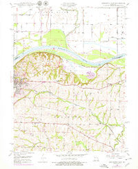
~ Lexington East MO topo map, 1:24000 scale, 7.5 X 7.5 Minute, Historical, 1949, updated 1978
Lexington East, Missouri, USGS topographic map dated 1949.
Includes geographic coordinates (latitude and longitude). This topographic map is suitable for hiking, camping, and exploring, or framing it as a wall map.
Printed on-demand using high resolution imagery, on heavy weight and acid free paper, or alternatively on a variety of synthetic materials.
Topos available on paper, Waterproof, Poly, or Tyvek. Usually shipping rolled, unless combined with other folded maps in one order.
- Product Number: USGS-5578844
- Free digital map download (high-resolution, GeoPDF): Lexington East, Missouri (file size: 11 MB)
- Map Size: please refer to the dimensions of the GeoPDF map above
- Weight (paper map): ca. 55 grams
- Map Type: POD USGS Topographic Map
- Map Series: HTMC
- Map Verison: Historical
- Cell ID: 25596
- Scan ID: 323292
- Imprint Year: 1978
- Woodland Tint: Yes
- Photo Revision Year: 1978
- Aerial Photo Year: 1977
- Edit Year: 1978
- Field Check Year: 1949
- Survey Year: 1949
- Datum: NAD27
- Map Projection: Polyconic
- Map published by United States Geological Survey
- Map published by United States Army Corps of Engineers
- Map Language: English
- Scanner Resolution: 600 dpi
- Map Cell Name: Lexington East
- Grid size: 7.5 X 7.5 Minute
- Date on map: 1949
- Map Scale: 1:24000
- Geographical region: Missouri, United States
Neighboring Maps:
All neighboring USGS topo maps are available for sale online at a variety of scales.
Spatial coverage:
Topo map Lexington East, Missouri, covers the geographical area associated the following places:
- Lafayette D10 Lake - Lick Fork - Dickmeyer Lake - Long Branch - Northrup - Petsch Dam (historical) - Tabo Creek Watershed Structure C-25 Dam - Sam Smiths Lake (historical) - Wentworth Military Academy - Lexington City Park Dam - Number 143 Reservoir - Carter Lake Section 11 Dam - Starke Lake Dam - Lexington Bend - Tabo Creek Watershed Structure D-20 Dam - Locust Grove School (historical) - Carter Lake Section 25 Lower Dam - Number 141 Reservoir - Tabo Bend - Winton - Ladys Lake Dam - Township of Lexington - KLEX-AM (Lexington) - Wentworth Country Club - Carter Lake Section 10 Lower Dam - Garrison Creek - Tabo Creek Watershed Structure C-27 Dam - Leslie Bell Elementary School - City of Lexington - Tabo Creek Watershed Structure D-28 Dam - Tabo Creek Watershed Structure C-28 Dam - Tabo Creek Watershed Structure D-26 Dam - Halls - Carter Lake Section 25 Upper Dam - Tabo Creek Watershed Structure D-23 Dam - Crooked River - Sauk Prairie - Tabo Creek Watershed Structure D-24 Dam - Lexington Middle School - Tabo Creek Watershed Structure D-30 Dam - Hicklin School (historical) - Lex La - Ray Technical Center - Number 185 Reservoir - Tabo Creek Watershed Structure C-33 Dam - Slusher School (historical) - Lions Club Lake Number 10298 - KCAC-FM (Lexington) - Mallory School (historical) - Tabo Creek Watershed Structure A-22 Dam - Forest Grove Cemetery - Number 140 Reservoir - Hicklin Lake - Tabo Creek Watershed Structure D-29 Dam - Carter Lake Section 10 Upper Dam - Slusher Cemetery - Burns School (historical) - Palmer Sill Lake - Prairie Valley School (historical) - Tabo Creek Watershed Structure C-29 Dam - Oak Grove School (historical) - Crystal Lakes Dam - Lexington High School - Sheep Nose Bend
- Map Area ID: AREA39.2539.125-93.875-93.75
- Northwest corner Lat/Long code: USGSNW39.25-93.875
- Northeast corner Lat/Long code: USGSNE39.25-93.75
- Southwest corner Lat/Long code: USGSSW39.125-93.875
- Southeast corner Lat/Long code: USGSSE39.125-93.75
- Northern map edge Latitude: 39.25
- Southern map edge Latitude: 39.125
- Western map edge Longitude: -93.875
- Eastern map edge Longitude: -93.75


